ملف:Monocacy.png
حجم هذه المعاينة: 511 × 599 بكسل. البعد الآخر: 1٬000 × 1٬172 بكسل.
الملف الأصلي (1٬000 × 1٬172 بكسل حجم الملف: 544 كيلوبايت، نوع MIME: image/png)
وصف قصير
| ⧼wm-license-information-description⧽ |
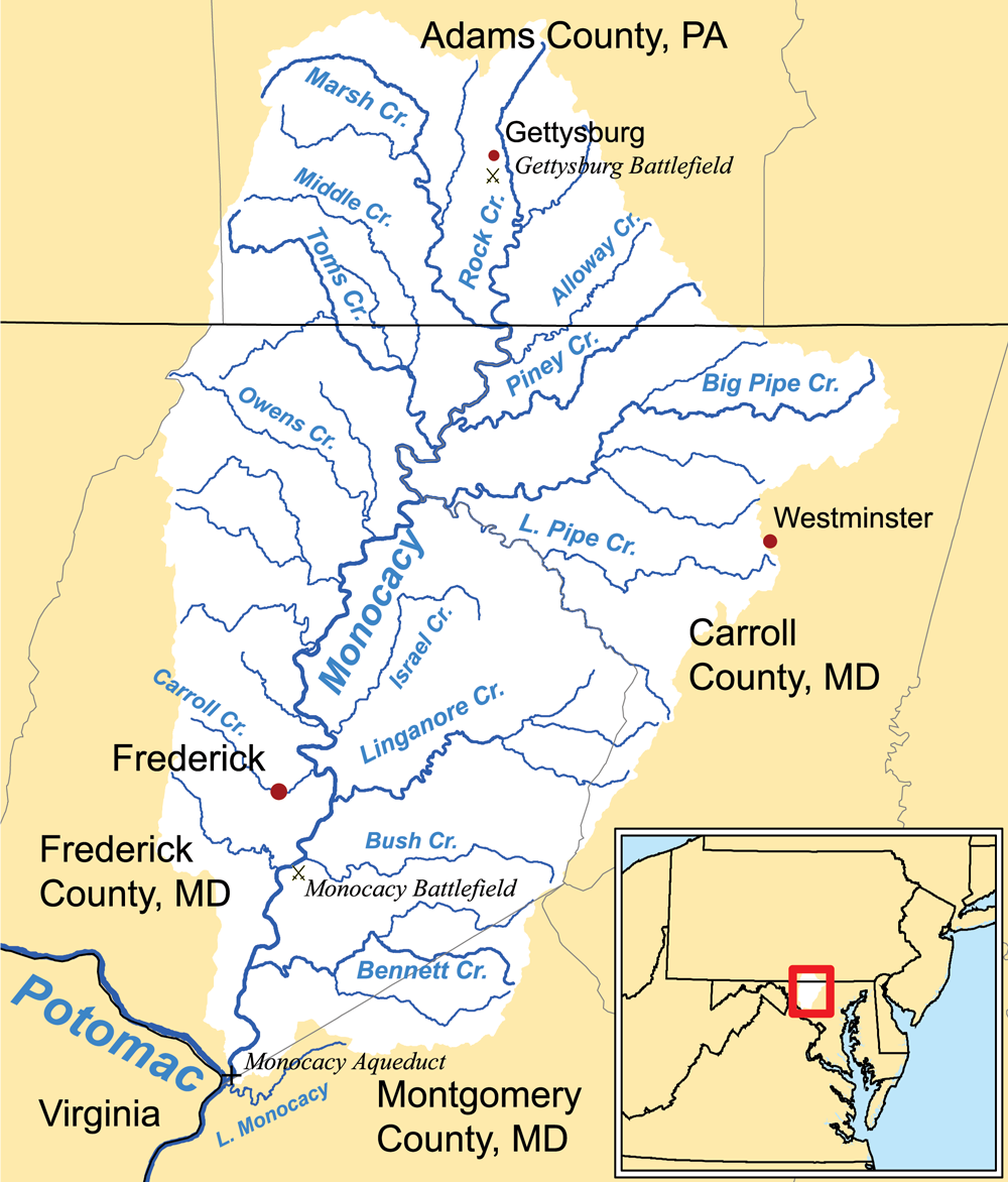
This is a map of the Monocacy River Watershed I made using USGS and Census Bureau data. |
| ⧼wm-license-information-date⧽ | قالب:Original upload date |
| ⧼wm-license-information-source⧽ | No machine-readable source provided. Own work assumed (based on copyright claims). |
| ⧼wm-license-information-author⧽ | No machine-readable author provided. Kmusser assumed (based on copyright claims). |
ترخيص
تاريخ الملف
اضغط على زمن/تاريخ لرؤية الملف كما بدا في هذا الزمن.
| زمن/تاريخ | صورة مصغرة | الأبعاد | مستخدم | تعليق | |
|---|---|---|---|---|---|
| حالي | ★ مراجعة معتمدة 14:32، 25 أكتوبر 2023 | | 1٬000 × 1٬172 (544 كيلوبايت) | Pastakhov (نقاش | مساهمات) | Upload https://upload.wikimedia.org/wikipedia/commons/1/10/Monocacy.png |
لا يمكنك استبدال هذا الملف.
وصلات
الصفحات التالية تحتوي على وصلة لهذه الصورة: