ملف:Missouri territory formerly Louisiana. LOC 2001620467.jpg
حجم هذه المعاينة: 668 × 600 بكسل. البعدان الآخران: 2٬280 × 2٬048 بكسل | 4٬290 × 3٬853 بكسل.
الملف الأصلي (4٬290 × 3٬853 بكسل حجم الملف: 2٫52 ميجابايت، نوع MIME: image/jpeg)
وصف قصير
| ⧼wm-license-information-description⧽ |
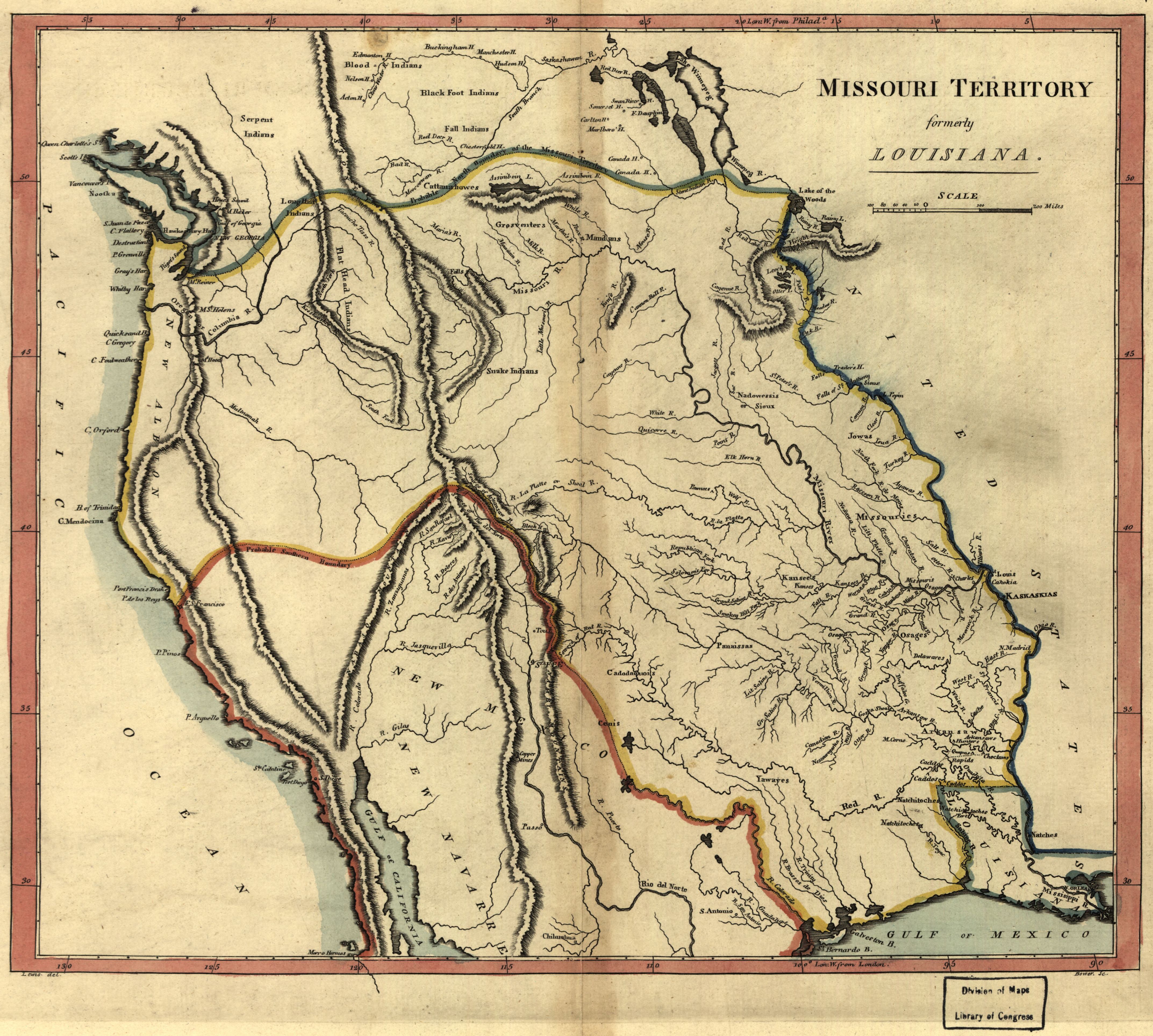
English: Shows boundaries of Missouri Territory. Available also through the Library of Congress web site as a raster image.
|
| Title | Missouri territory formerly Louisiana. |
| Shelf ID | G4050 1814 .C3 TIL |
| ⧼wm-license-information-date⧽ | 1814 |
| ⧼wm-license-information-source⧽ | https://www.loc.gov/item/2001620467/ |
| ⧼wm-license-information-author⧽ | Carey, Mathew |
| ⧼wm-license-information-permission⧽ (⧼wm-license-information-permission-reusing-text⧽) |
|
| ⧼wm-license-information-other-versions⧽ |
|
| Location | United States · West · Canada · Prairie Provinces |
| Part of | American Memory · Catalog · Louisiana: European Explorations And The Louisiana Purchase · Geography And Map Division · Discovery And Exploration |
| Subject | Canada · West · Prairie Provinces · West (U.S.) · United States · Maps |
ترخيص
|
قالب:PD-old-100-1923
The official position taken by the Wikimedia Foundation is that "faithful reproductions of two-dimensional public domain works of art are public domain, and that claims to the contrary represent an assault on the very concept of a public domain". For details, see Commons:When to use the PD-Art tag.
|
تاريخ الملف
اضغط على زمن/تاريخ لرؤية الملف كما بدا في هذا الزمن.
| زمن/تاريخ | صورة مصغرة | الأبعاد | مستخدم | تعليق | |
|---|---|---|---|---|---|
| حالي | ★ مراجعة معتمدة 22:04، 3 ديسمبر 2023 | | 4٬290 × 3٬853 (2٫52 ميجابايت) | Pastakhov (نقاش | مساهمات) | Upload https://upload.wikimedia.org/wikipedia/commons/3/32/Missouri_territory_formerly_Louisiana._LOC_2001620467.jpg |
لا يمكنك استبدال هذا الملف.
وصلات
لا يوجد صفحات تصل لهذه الصورة.