ملف:Minnigaff Parish Church, Dumfries and Galloway - geograph.org.uk - 1585098.jpg
لا توجد دقة أعلى متوفرة.
Minnigaff_Parish_Church,_Dumfries_and_Galloway_-_geograph.org.uk_-_1585098.jpg (640 × 449 بكسل حجم الملف: 75 كيلوبايت، نوع MIME: image/jpeg)
وصف قصير
| ⧼wm-license-information-description⧽ |
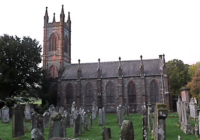
English: Minnigaff Parish Church, Dumfries and Galloway The church, churchyard and cemetery lie on elevated ground at the confluence of two rivers - the Cree and the Penkiln Burn - just north of Newton Stewart town centre. This is a tranquil spot, as befits its usage.
|
| ⧼wm-license-information-date⧽ | 2008 |
| ⧼wm-license-information-source⧽ | From geograph.org.uk |
| ⧼wm-license-information-author⧽ | Anthony O'Neil |
| ⧼wm-license-cc-attribution⧽ (قالب:I18n/Credit line) |
Anthony O'Neil / Minnigaff Parish Church, Dumfries and Galloway / |
54°58′06″N 4°29′05″W / 54.96846°N 4.4847°W قالب:Object location
_heading:315)
ترخيص
تاريخ الملف
اضغط على زمن/تاريخ لرؤية الملف كما بدا في هذا الزمن.
| زمن/تاريخ | صورة مصغرة | الأبعاد | مستخدم | تعليق | |
|---|---|---|---|---|---|
| حالي | ★ مراجعة معتمدة 16:15، 7 أكتوبر 2023 | | 640 × 449 (75 كيلوبايت) | Pastakhov (نقاش | مساهمات) | Upload https://upload.wikimedia.org/wikipedia/commons/4/4e/Minnigaff_Parish_Church%2C_Dumfries_and_Galloway_-_geograph.org.uk_-_1585098.jpg |
لا يمكنك استبدال هذا الملف.
وصلات
لا يوجد صفحات تصل لهذه الصورة.