ملف:Mediterranean Basin.png
حجم هذه المعاينة: 800 × 585 بكسل. البعد الآخر: 923 × 675 بكسل.
الملف الأصلي (923 × 675 بكسل حجم الملف: 63 كيلوبايت، نوع MIME: image/png)
وصف قصير
| ⧼wm-license-information-description⧽ |
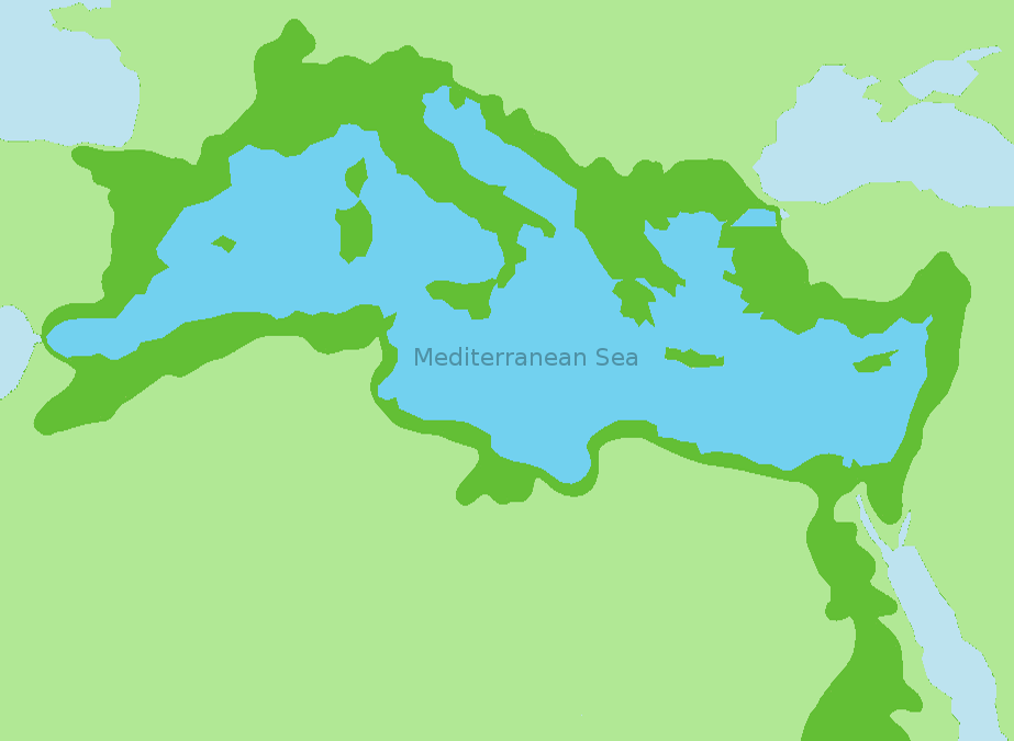
English: Approximate extent of the (active) Mediterranean drainage basin (dark green). Based on a United Nations Environment Programme (UNEP) map;
|
| ⧼wm-license-information-date⧽ | 2022 |
| ⧼wm-license-information-source⧽ | ⧼Wm-license-own-work⧽ |
| ⧼wm-license-information-author⧽ | Zacharie Grossen |
ترخيص
|
تاريخ الملف
اضغط على زمن/تاريخ لرؤية الملف كما بدا في هذا الزمن.
| زمن/تاريخ | صورة مصغرة | الأبعاد | مستخدم | تعليق | |
|---|---|---|---|---|---|
| حالي | ★ مراجعة معتمدة 23:36، 6 نوفمبر 2023 | | 923 × 675 (63 كيلوبايت) | Pastakhov (نقاش | مساهمات) | Upload https://upload.wikimedia.org/wikipedia/commons/4/42/Mediterranean_Basin.png |
لا يمكنك استبدال هذا الملف.
وصلات
لا يوجد صفحات تصل لهذه الصورة.