ملف:Medieval map of Cairo.png
حجم هذه المعاينة: 379 × 599 بكسل. البعد الآخر: 1٬336 × 2٬112 بكسل.
الملف الأصلي (1٬336 × 2٬112 بكسل حجم الملف: 298 كيلوبايت، نوع MIME: image/png)
وصف قصير
قالب:Uploaded with en.wp UW marker
| ⧼wm-license-information-description⧽ |
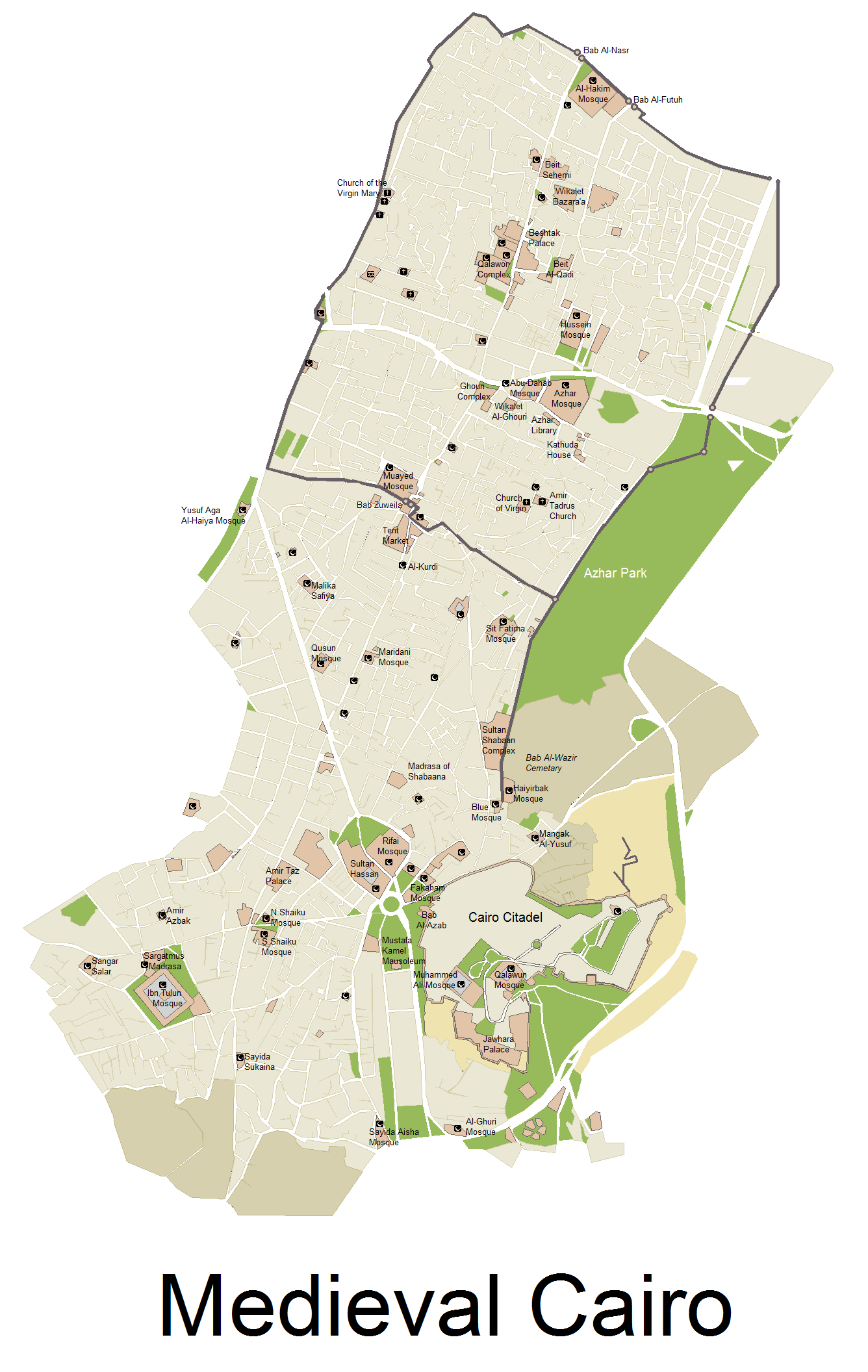
English: A Map showing the size of Medieval Cairo, with remaining Monuments today, map Includes Cairo from its establishing, till the late 17th century - NOTE: Bab Al-Futuh and Bab Al-Nasr are wrongly switched. See revised version here: https://commons.wikimedia.org/wiki/File:Medieval_map_of_Cairo_revised.png
|
| ⧼wm-license-information-date⧽ | 2012 |
| ⧼wm-license-information-source⧽ | i used several Print screens from a google map, and then worked on it via Microsoft paint, and then searched for boundries of the city, and location of monuments online. Previously published: i have previously published this on http://www.skyscrapercity.com/showthread.php?t=1553826 |
| ⧼wm-license-information-author⧽ | Arab Hafez |
ترخيص
|

تاريخ الملف
اضغط على زمن/تاريخ لرؤية الملف كما بدا في هذا الزمن.
| زمن/تاريخ | صورة مصغرة | الأبعاد | مستخدم | تعليق | |
|---|---|---|---|---|---|
| حالي | ★ مراجعة معتمدة 09:18، 30 نوفمبر 2023 | | 1٬336 × 2٬112 (298 كيلوبايت) | Pastakhov (نقاش | مساهمات) | Upload https://upload.wikimedia.org/wikipedia/commons/b/bd/Medieval_map_of_Cairo.png |
لا يمكنك استبدال هذا الملف.
وصلات
لا يوجد صفحات تصل لهذه الصورة.