ملف:McDonald's, Swaythling - geograph.org.uk - 1564319.jpg
لا توجد دقة أعلى متوفرة.
McDonald's,_Swaythling_-_geograph.org.uk_-_1564319.jpg (640 × 480 بكسل حجم الملف: 68 كيلوبايت، نوع MIME: image/jpeg)
وصف قصير
| ⧼wm-license-information-description⧽ |
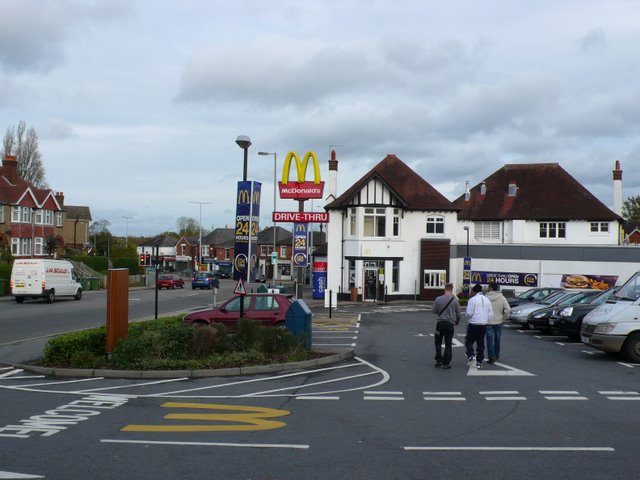
English: McDonald's, Swaythling This is the McDonald's restaurant at 77, High Rd Swaythling at the junction with Burgess Rd. This building which it occupies used to be the Old Black Cat pub. It was converted into the McDonald's in the late 1990's. Prior to that it had been the Hampton Park Hotel. It is recorded under this name in 1926 and probably changed to the Old Black Cat after the second world war.
|
| ⧼wm-license-information-date⧽ | 2009 |
| ⧼wm-license-information-source⧽ | From geograph.org.uk |
| ⧼wm-license-information-author⧽ | Nigel Mykura |
| ⧼wm-license-cc-attribution⧽ (قالب:I18n/Credit line) |
Nigel Mykura / McDonald's, Swaythling / |
50°56′20″N 1°22′52″W / 50.93888°N 1.3812°W قالب:Object location
_heading:90)
ترخيص
تاريخ الملف
اضغط على زمن/تاريخ لرؤية الملف كما بدا في هذا الزمن.
| زمن/تاريخ | صورة مصغرة | الأبعاد | مستخدم | تعليق | |
|---|---|---|---|---|---|
| حالي | ★ مراجعة معتمدة 12:32، 28 نوفمبر 2023 | | 640 × 480 (68 كيلوبايت) | Pastakhov (نقاش | مساهمات) | Upload https://upload.wikimedia.org/wikipedia/commons/f/fa/McDonald%27s%2C_Swaythling_-_geograph.org.uk_-_1564319.jpg |
لا يمكنك استبدال هذا الملف.
وصلات
لا يوجد صفحات تصل لهذه الصورة.