ملف:Mayo North and West Dáil constituency 1921-1923.png
حجم هذه المعاينة: 470 × 599 بكسل. البعد الآخر: 728 × 928 بكسل.
الملف الأصلي (728 × 928 بكسل حجم الملف: 49 كيلوبايت، نوع MIME: image/png)
وصف قصير
| ⧼wm-license-information-description⧽ |
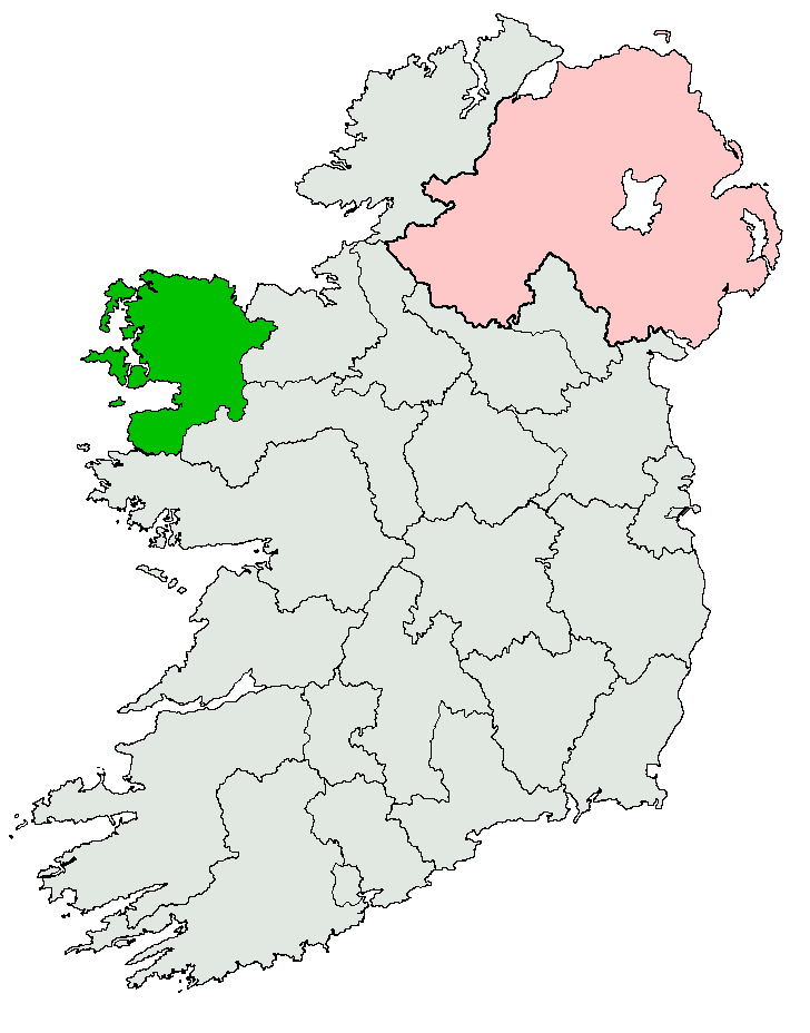
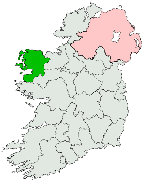
English: Map depicting the former Irish electoral constituency of Mayo North and West, created under the Government of Ireland Act 1920 and abolished under the Electoral Act of 1923.
|
| ⧼wm-license-information-date⧽ | |
| ⧼wm-license-information-source⧽ | ⧼Wm-license-own-work⧽ |
| ⧼wm-license-information-author⧽ | JandK87 |
| ⧼wm-license-information-permission⧽ (⧼wm-license-information-permission-reusing-text⧽) |
Public domain. |
ترخيص
تاريخ الملف
اضغط على زمن/تاريخ لرؤية الملف كما بدا في هذا الزمن.
| زمن/تاريخ | صورة مصغرة | الأبعاد | مستخدم | تعليق | |
|---|---|---|---|---|---|
| حالي | ★ مراجعة معتمدة 18:28، 19 يناير 2024 | | 728 × 928 (49 كيلوبايت) | Pastakhov (نقاش | مساهمات) | Upload https://upload.wikimedia.org/wikipedia/commons/7/79/Mayo_North_and_West_D%C3%A1il_constituency_1921-1923.png |
لا يمكنك استبدال هذا الملف.
وصلات
لا يوجد صفحات تصل لهذه الصورة.