ملف:Markyate, The High Street - geograph.org.uk - 168514.jpg
لا توجد دقة أعلى متوفرة.
Markyate,_The_High_Street_-_geograph.org.uk_-_168514.jpg (640 × 480 بكسل حجم الملف: 78 كيلوبايت، نوع MIME: image/jpeg)
وصف قصير
| ⧼wm-license-information-description⧽ |
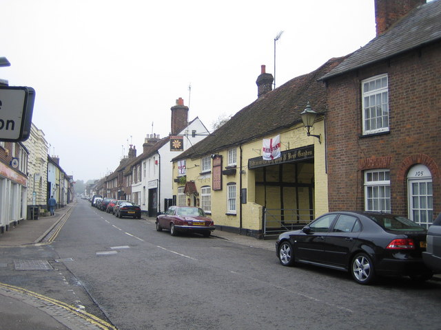
English: Markyate: The High Street. Once the Roman Road Watling Street, then the arterial A5 road, and then by-passed by the A5, this is now just the High Street in the centre of Markyate. The Sun Inn, which is the pale yellow building on the right side of the street, bears witness to its former use as a stagecoach inn. The 1884 Ordnance Survey map calls the town Markyatestreet.
|
| ⧼wm-license-information-date⧽ | 2006 |
| ⧼wm-license-information-source⧽ | From geograph.org.uk |
| ⧼wm-license-information-author⧽ | Nigel Cox |
| ⧼wm-license-cc-attribution⧽ (قالب:I18n/Credit line) |
Nigel Cox / Markyate: The High Street / |
ترخيص
تاريخ الملف
اضغط على زمن/تاريخ لرؤية الملف كما بدا في هذا الزمن.
| زمن/تاريخ | صورة مصغرة | الأبعاد | مستخدم | تعليق | |
|---|---|---|---|---|---|
| حالي | ★ مراجعة معتمدة 08:50، 9 أكتوبر 2023 | | 640 × 480 (78 كيلوبايت) | Pastakhov (نقاش | مساهمات) | Upload https://upload.wikimedia.org/wikipedia/commons/8/8a/Markyate%2C_The_High_Street_-_geograph.org.uk_-_168514.jpg |
لا يمكنك استبدال هذا الملف.
وصلات
لا يوجد صفحات تصل لهذه الصورة.