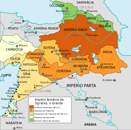
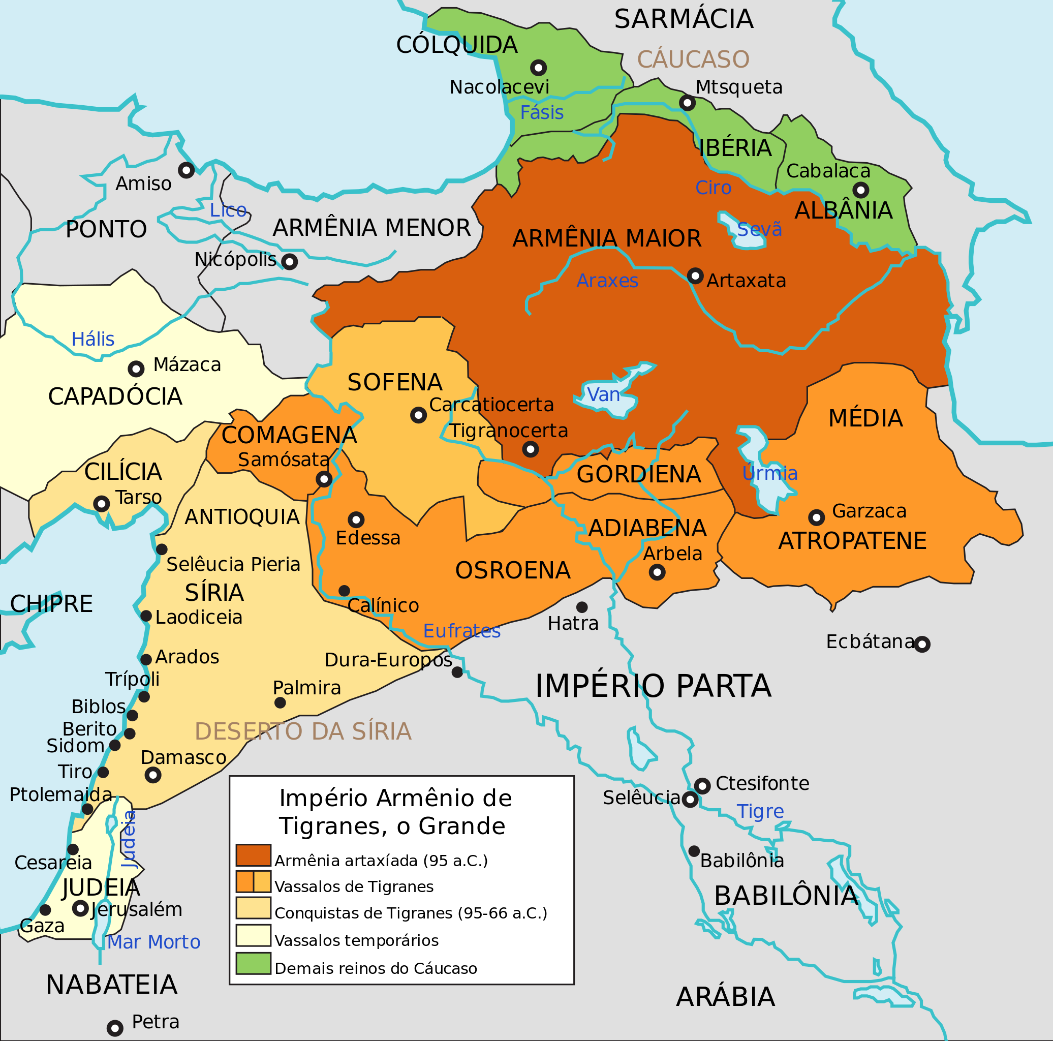
ملف:Maps of the Armenian Empire of Tigranes-pt.svg

حجم معاينة PNG لذلك الملف ذي الامتداد SVG: 512 × 506 بكسل. البعد الآخر: 2٬072 × 2٬048 بكسل.
الملف الأصلي (ملف SVG، أبعاده 512 × 506 بكسل، حجم الملف: 50 كيلوبايت)
وصف قصير
| ⧼wm-license-information-description⧽ |
(Portuguese) |
| ⧼wm-license-information-date⧽ | 2014, {{time}} – invalid date format 38 (help) |
| ⧼wm-license-information-source⧽ | قالب:Derived from |
| ⧼wm-license-information-author⧽ | خطأ: لا توجد وحدة بهذا الاسم "user". |
| ⧼wm-license-information-other-versions⧽ |
ترخيص
تاريخ الملف
اضغط على زمن/تاريخ لرؤية الملف كما بدا في هذا الزمن.
| زمن/تاريخ | صورة مصغرة | الأبعاد | مستخدم | تعليق | |
|---|---|---|---|---|---|
| حالي | ★ مراجعة معتمدة 00:41، 9 أكتوبر 2023 | | 512 × 506 (50 كيلوبايت) | Pastakhov (نقاش | مساهمات) | Upload https://upload.wikimedia.org/wikipedia/commons/1/1d/Maps_of_the_Armenian_Empire_of_Tigranes-pt.svg |
لا يمكنك استبدال هذا الملف.
وصلات
لا يوجد صفحات تصل لهذه الصورة.
معلومات الصورة (ميتا)
تصنيفات:
- Maps of ancient Armenia
- Maps showing 1st-century BC history
- Maps of Cappadocia
- Maps of the history of the Caucasus in antiquity
- SVG maps of the history of Azerbaijan
- Maps of the history of Georgia
- Maps of the history of Turkey
- Maps of the history of Syria
- Maps of the history of Israel
- Maps of the history of Iraq
- Maps of the Middle East
- Maps of Parthia
- Maps of Colchis
- Maps of the Kingdom of Iberia
- Maps of Caucasian Albania
- Georgia in the 1st century BC
- Maps of Sarmatia
- Maps of Corduene
- Maps of Sophene
- Maps of Commagene
- SVG maps of the ancient Near East
- Maps of Osrhoene
- Maps of Adiabene