ملف:Mapa de la frontera marítima Ecuador-Perú.svg

حجم معاينة PNG لذلك الملف ذي الامتداد SVG: 800 × 523 بكسل. البعد الآخر: 2٬560 × 1٬673 بكسل.
الملف الأصلي (ملف SVG، أبعاده 932 × 609 بكسل، حجم الملف: 144 كيلوبايت)
وصف قصير
| ⧼wm-license-information-description⧽ |
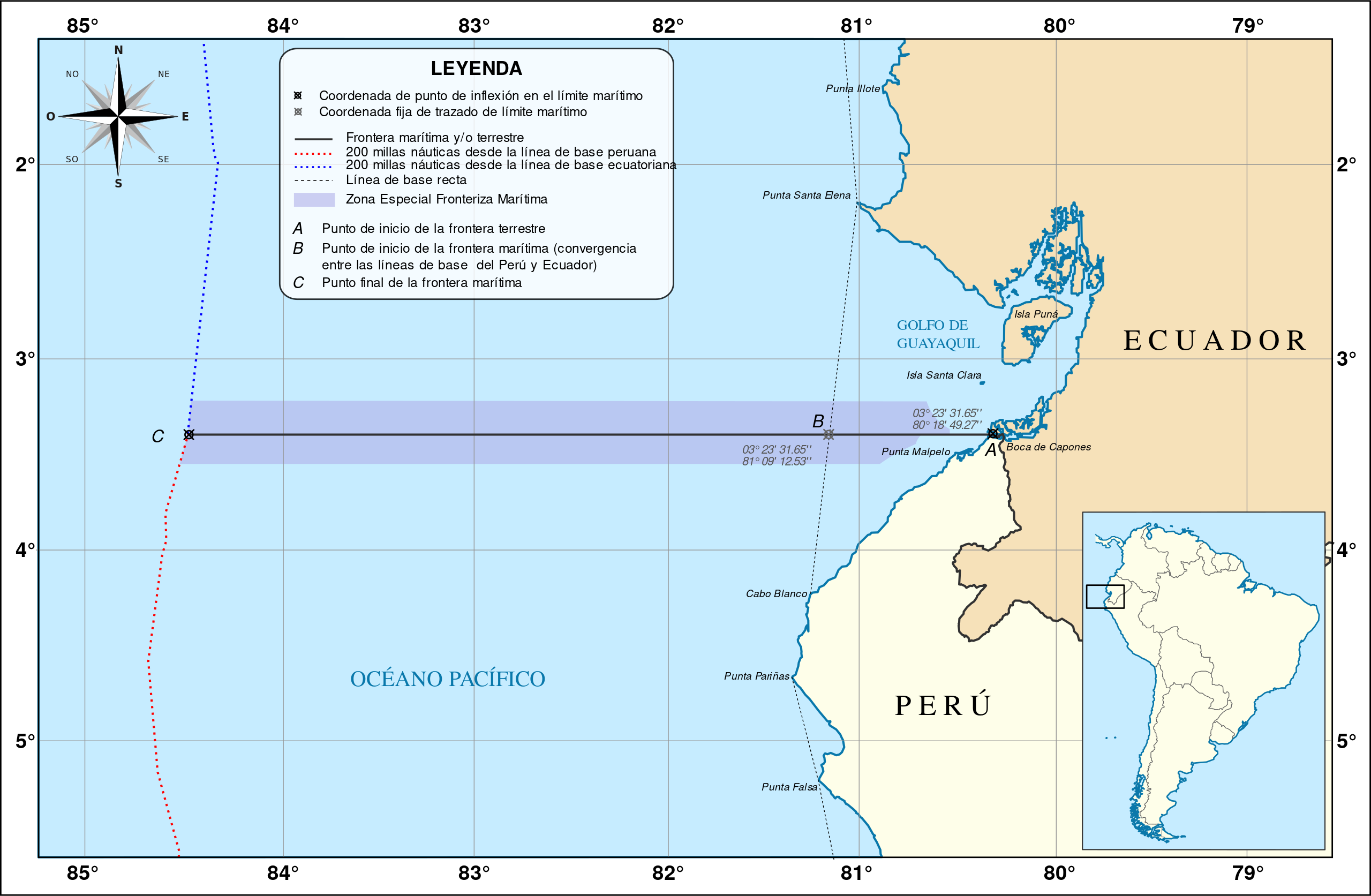
Español: Mapa mostrando el límite marítimo acordado entre los gobiernos de Ecuador y Perú el 2 de mayo de 2011.
|
| ⧼wm-license-information-date⧽ | 2014, {{time}} – invalid date format 02 (help) |
| ⧼wm-license-information-source⧽ | ⧼Wm-license-own-work⧽
|
| ⧼wm-license-information-author⧽ | Shadowxfox |
ترخيص
|
تاريخ الملف
اضغط على زمن/تاريخ لرؤية الملف كما بدا في هذا الزمن.
| زمن/تاريخ | صورة مصغرة | الأبعاد | مستخدم | تعليق | |
|---|---|---|---|---|---|
| حالي | ★ مراجعة معتمدة 22:57، 10 نوفمبر 2023 | | 932 × 609 (144 كيلوبايت) | Pastakhov (نقاش | مساهمات) | Upload https://upload.wikimedia.org/wikipedia/commons/f/f3/Mapa_de_la_frontera_mar%C3%ADtima_Ecuador-Per%C3%BA.svg |
لا يمكنك استبدال هذا الملف.
وصلات
لا يوجد صفحات تصل لهذه الصورة.