ملف:Mapa Lagunillas.PNG
حجم هذه المعاينة: 596 × 599 بكسل. البعد الآخر: 880 × 885 بكسل.
الملف الأصلي (880 × 885 بكسل حجم الملف: 130 كيلوبايت، نوع MIME: image/png)
وصف قصير
| ⧼wm-license-information-description⧽ |
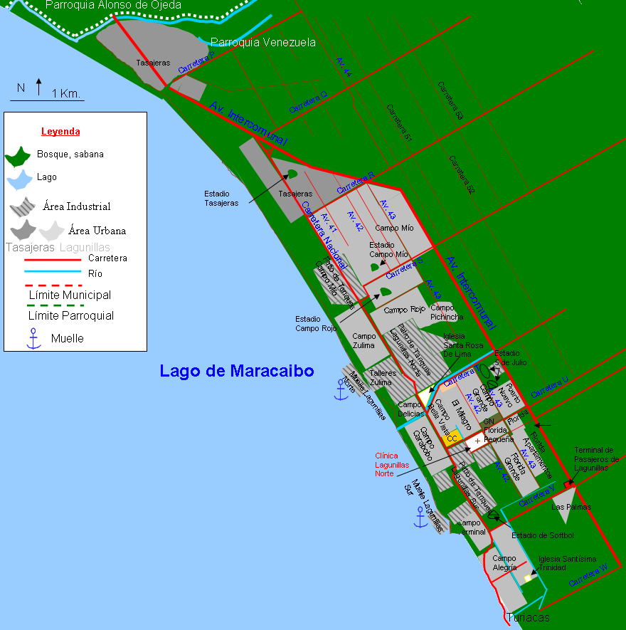
Español: Mapa de la ciudad de Lagunillas. Municipio Lagunillas. Estado Zulia. Venezuela. Sólo se muestran las calles principales. Se muestra junto al pueblo conurbado de Tasajeras, no se ve conurbado en el mapa porque Tasajeras está en proceso de abandono y reubicación de sus habitantes. Turiacas otro pueblo al que se hace referencia en la parte inferior derecha está 98 % abandonado y es un pueblo fantasma.
|
| ⧼wm-license-information-date⧽ | 2012 |
| ⧼wm-license-information-source⧽ | ⧼Wm-license-own-work⧽ |
| ⧼wm-license-information-author⧽ | Andrés González |
ترخيص
|
تاريخ الملف
اضغط على زمن/تاريخ لرؤية الملف كما بدا في هذا الزمن.
| زمن/تاريخ | صورة مصغرة | الأبعاد | مستخدم | تعليق | |
|---|---|---|---|---|---|
| حالي | ★ مراجعة معتمدة 23:01، 6 أكتوبر 2023 | | 880 × 885 (130 كيلوبايت) | Pastakhov (نقاش | مساهمات) | Upload https://upload.wikimedia.org/wikipedia/commons/0/03/Mapa_Lagunillas.PNG |
لا يمكنك استبدال هذا الملف.
وصلات
لا يوجد صفحات تصل لهذه الصورة.