ملف:Map of the sultanate of touggourt.jpg
حجم هذه المعاينة: 800 × 415 بكسل. البعدان الآخران: 2٬560 × 1٬327 بكسل | 5٬000 × 2٬592 بكسل.
الملف الأصلي (5٬000 × 2٬592 بكسل حجم الملف: 387 كيلوبايت، نوع MIME: image/jpeg)
وصف قصير
| ⧼wm-license-information-description⧽ |
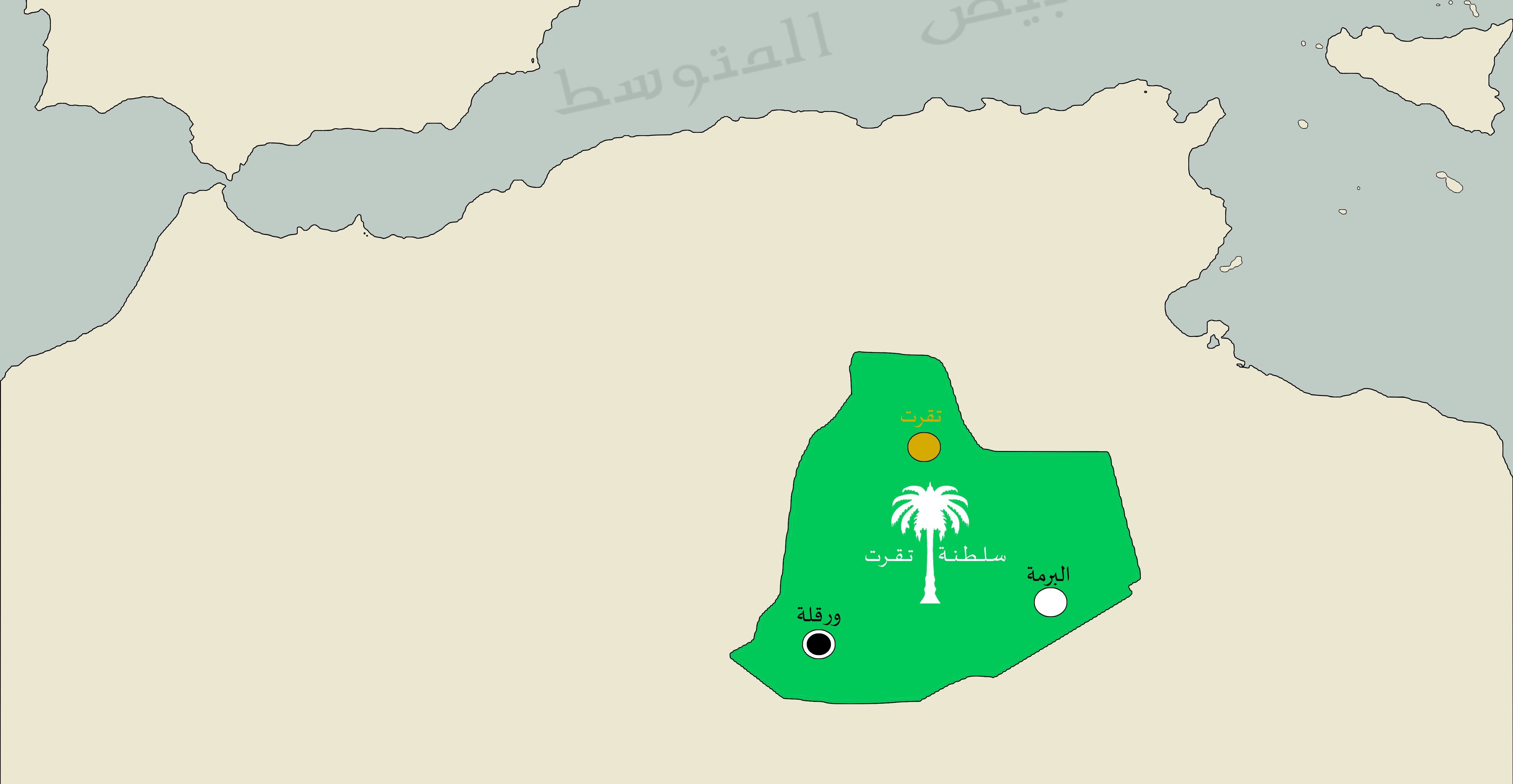
Français : Carte du Sultanat de Touggourt à son apogée en 1638
|
| ⧼wm-license-information-date⧽ | 2020 |
| ⧼wm-license-information-source⧽ | ⧼Wm-license-own-work⧽ |
| ⧼wm-license-information-author⧽ | Idriss265 |
ترخيص
|
تاريخ الملف
اضغط على زمن/تاريخ لرؤية الملف كما بدا في هذا الزمن.
| زمن/تاريخ | صورة مصغرة | الأبعاد | مستخدم | تعليق | |
|---|---|---|---|---|---|
| حالي | ★ مراجعة معتمدة 15:02، 11 نوفمبر 2023 | | 5٬000 × 2٬592 (387 كيلوبايت) | Pastakhov (نقاش | مساهمات) | Upload https://upload.wikimedia.org/wikipedia/commons/6/68/Map_of_the_sultanate_of_touggourt.jpg |
لا يمكنك استبدال هذا الملف.
وصلات
لا يوجد صفحات تصل لهذه الصورة.