ملف:Map of the Western Cape with Stellenbosch highlighted (2011).svg

حجم معاينة PNG لذلك الملف ذي الامتداد SVG: 753 × 600 بكسل. البعد الآخر: 2٬560 × 2٬038 بكسل.
الملف الأصلي (ملف SVG، أبعاده 849 × 676 بكسل، حجم الملف: 330 كيلوبايت)
وصف قصير
| ⧼wm-license-information-description⧽ |
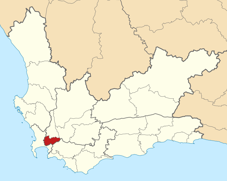
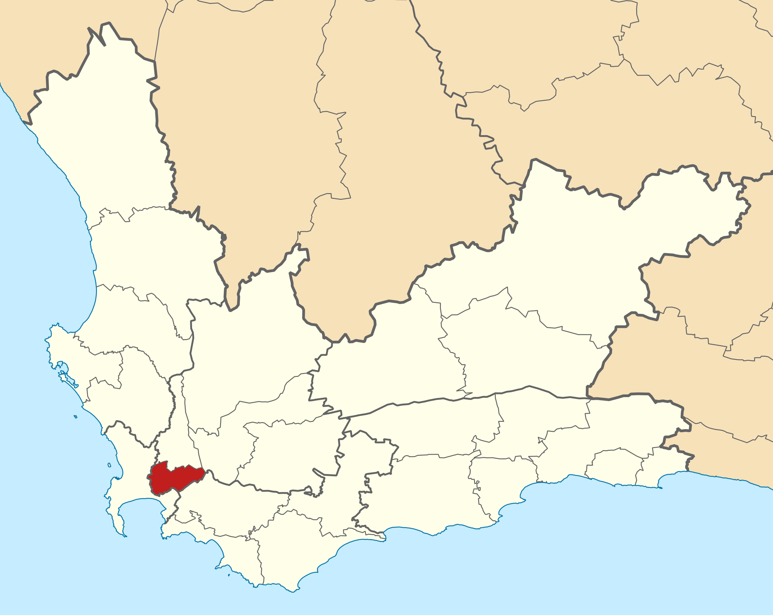
English: Map of municipal boundaries in the Western Cape, as they will be after the municipal elections of 18 May 2011, with the Stellenbosch Local Municipality highlighted in red. Based on File:Map of the Western Cape with municipalities blank (2011).svg.
|
| ⧼wm-license-information-date⧽ | 2011 |
| ⧼wm-license-information-source⧽ | ⧼Wm-license-own-work⧽ |
| ⧼wm-license-information-author⧽ | Htonl |
ترخيص
|

.svg&action=edit&redlink=1)
تاريخ الملف
اضغط على زمن/تاريخ لرؤية الملف كما بدا في هذا الزمن.
| زمن/تاريخ | صورة مصغرة | الأبعاد | مستخدم | تعليق | |
|---|---|---|---|---|---|
| حالي | ★ مراجعة معتمدة 14:48، 4 ديسمبر 2023 | | 849 × 676 (330 كيلوبايت) | Pastakhov (نقاش | مساهمات) | Upload https://upload.wikimedia.org/wikipedia/commons/a/a6/Map_of_the_Western_Cape_with_Stellenbosch_highlighted_%282011%29.svg |
لا يمكنك استبدال هذا الملف.
وصلات
لا يوجد صفحات تصل لهذه الصورة.
.svg&oldid=3693010)