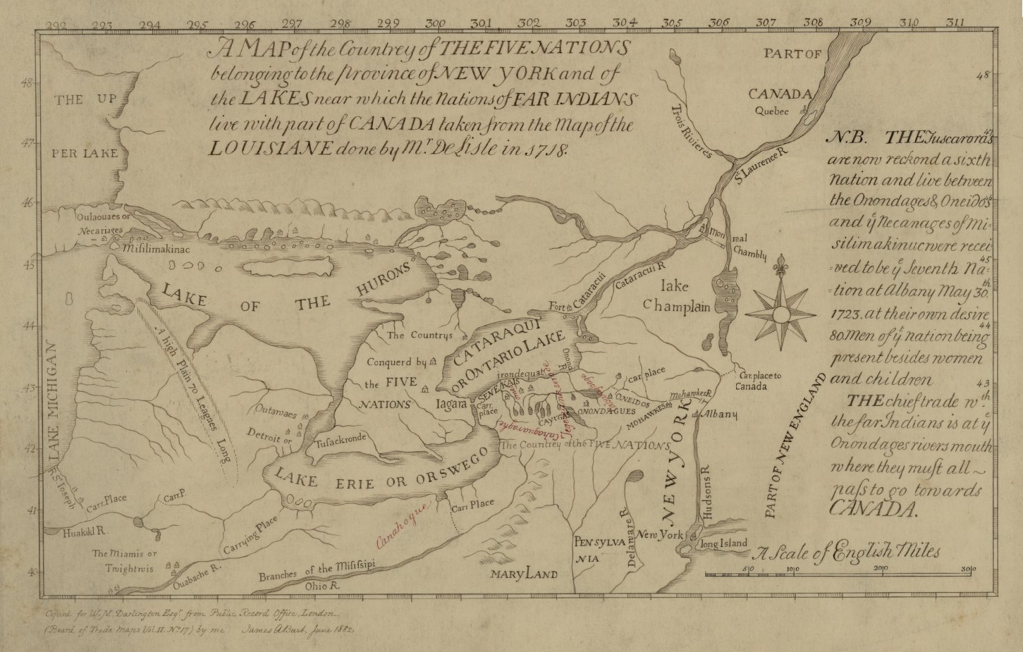
ملف:Map of the Country of the Five Nations belonging to the province of New York and of the Lakes near which the Nations of Far Indians live with part of Canada taken from the Map of the Louisiane done 1730.png
حجم هذه المعاينة: 800 × 510 بكسل. البعد الآخر: 1٬451 × 925 بكسل.
الملف الأصلي (1٬451 × 925 بكسل حجم الملف: 1٫52 ميجابايت، نوع MIME: image/png)
وصف قصير
| ⧼wm-license-information-description⧽ |
English: This is a map of the Five Nations that is part of the Darlington map collection housed in the Archives Service Center, University Library System, University of Pittsburgh, Pittsburgh Pittsburgh, PA US
|
| ⧼wm-license-information-date⧽ | 1730 |
| ⧼wm-license-information-source⧽ | The Darlington Collection |
| ⧼wm-license-information-author⧽ | style="background: #E4E4E4; color: black; vertical-align: middle; text-align: center; " class="unknown table-unknown"|author |
ترخيص
تاريخ الملف
اضغط على زمن/تاريخ لرؤية الملف كما بدا في هذا الزمن.
| زمن/تاريخ | صورة مصغرة | الأبعاد | مستخدم | تعليق | |
|---|---|---|---|---|---|
| حالي | ★ مراجعة معتمدة 22:24، 4 أكتوبر 2023 | | 1٬451 × 925 (1٫52 ميجابايت) | Pastakhov (نقاش | مساهمات) | Upload https://upload.wikimedia.org/wikipedia/commons/9/99/Map_of_the_Country_of_the_Five_Nations_belonging_to_the_province_of_New_York_and_of_the_Lakes_near_which_the_Nations_of_Far_Indians_live_with_part_of_Canada_taken_from_the_Map_of_the_Louisiane_done_1730.png |
لا يمكنك استبدال هذا الملف.
وصلات
لا يوجد صفحات تصل لهذه الصورة.