ملف:Map of Wari and Tiawaku.svg

حجم معاينة PNG لذلك الملف ذي الامتداد SVG: 267 × 365 بكسل. البعد الآخر: 1٬498 × 2٬048 بكسل.
الملف الأصلي (ملف SVG، أبعاده 267 × 365 بكسل، حجم الملف: 411 كيلوبايت)
وصف قصير
| ⧼wm-license-information-description⧽ |
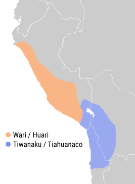
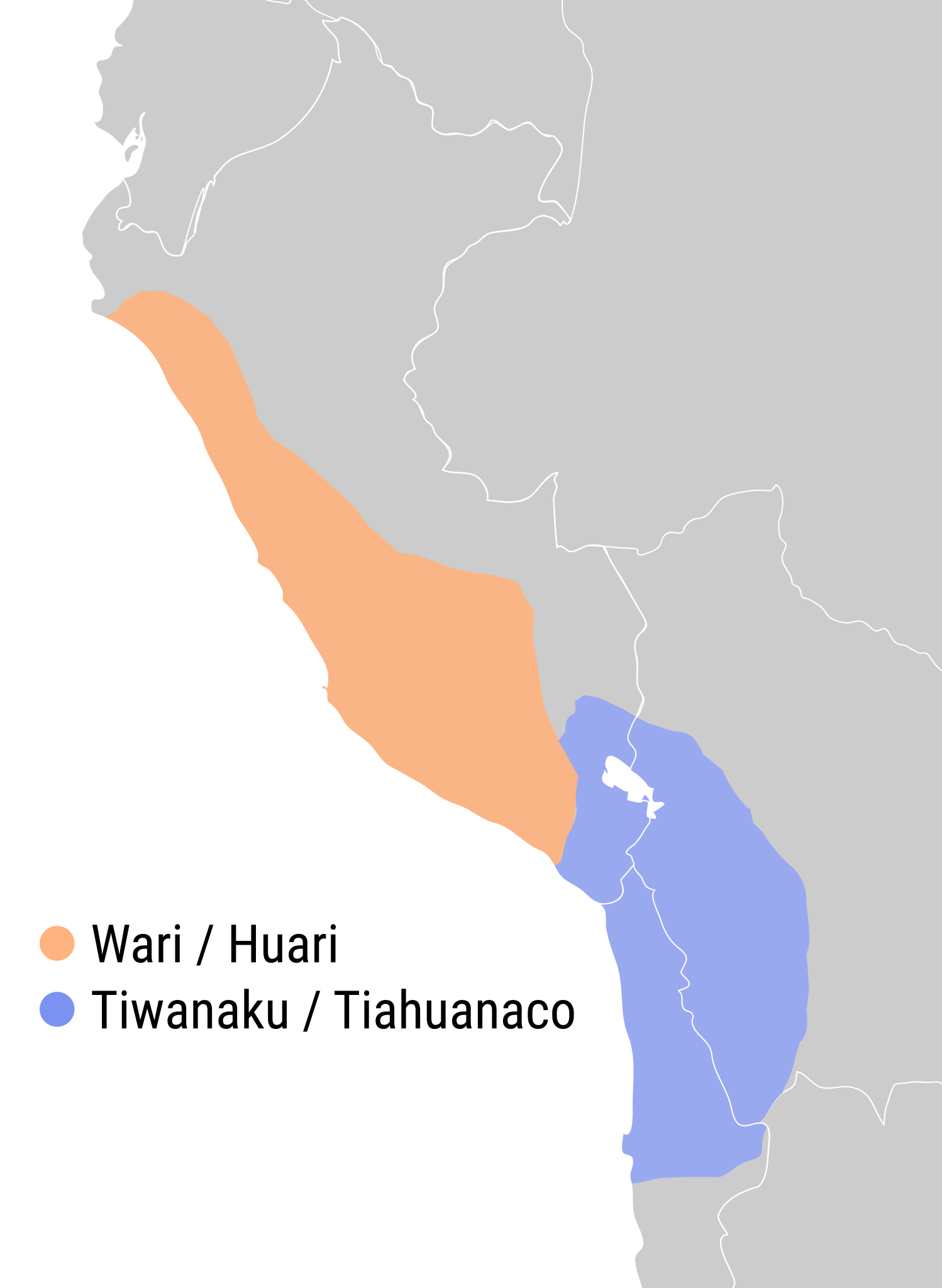
English: Expansion and area of influence of the Wari and Tiawaku cultures in the middle horizon with present day borders
|
| ⧼wm-license-information-date⧽ | 2017 |
| ⧼wm-license-information-source⧽ | ⧼Wm-license-own-work⧽ |
| ⧼wm-license-information-author⧽ | QQuantum |
| ⧼wm-license-information-other-versions⧽ |
|

ترخيص
|
تاريخ الملف
اضغط على زمن/تاريخ لرؤية الملف كما بدا في هذا الزمن.
| زمن/تاريخ | صورة مصغرة | الأبعاد | مستخدم | تعليق | |
|---|---|---|---|---|---|
| حالي | ★ مراجعة معتمدة 10:39، 11 نوفمبر 2023 | | 267 × 365 (411 كيلوبايت) | Pastakhov (نقاش | مساهمات) | Upload https://upload.wikimedia.org/wikipedia/commons/8/8b/Map_of_Wari_and_Tiawaku.svg |
لا يمكنك استبدال هذا الملف.
وصلات
لا يوجد صفحات تصل لهذه الصورة.