ملف:Map of Russia - Siberian Federal District (2018 composition).svg

حجم معاينة PNG لذلك الملف ذي الامتداد SVG: 800 × 462 بكسل. البعد الآخر: 2٬560 × 1٬477 بكسل.
الملف الأصلي (ملف SVG، أبعاده 1٬092 × 630 بكسل، حجم الملف: 61 كيلوبايت)
وصف قصير
| ⧼wm-license-information-description⧽ |
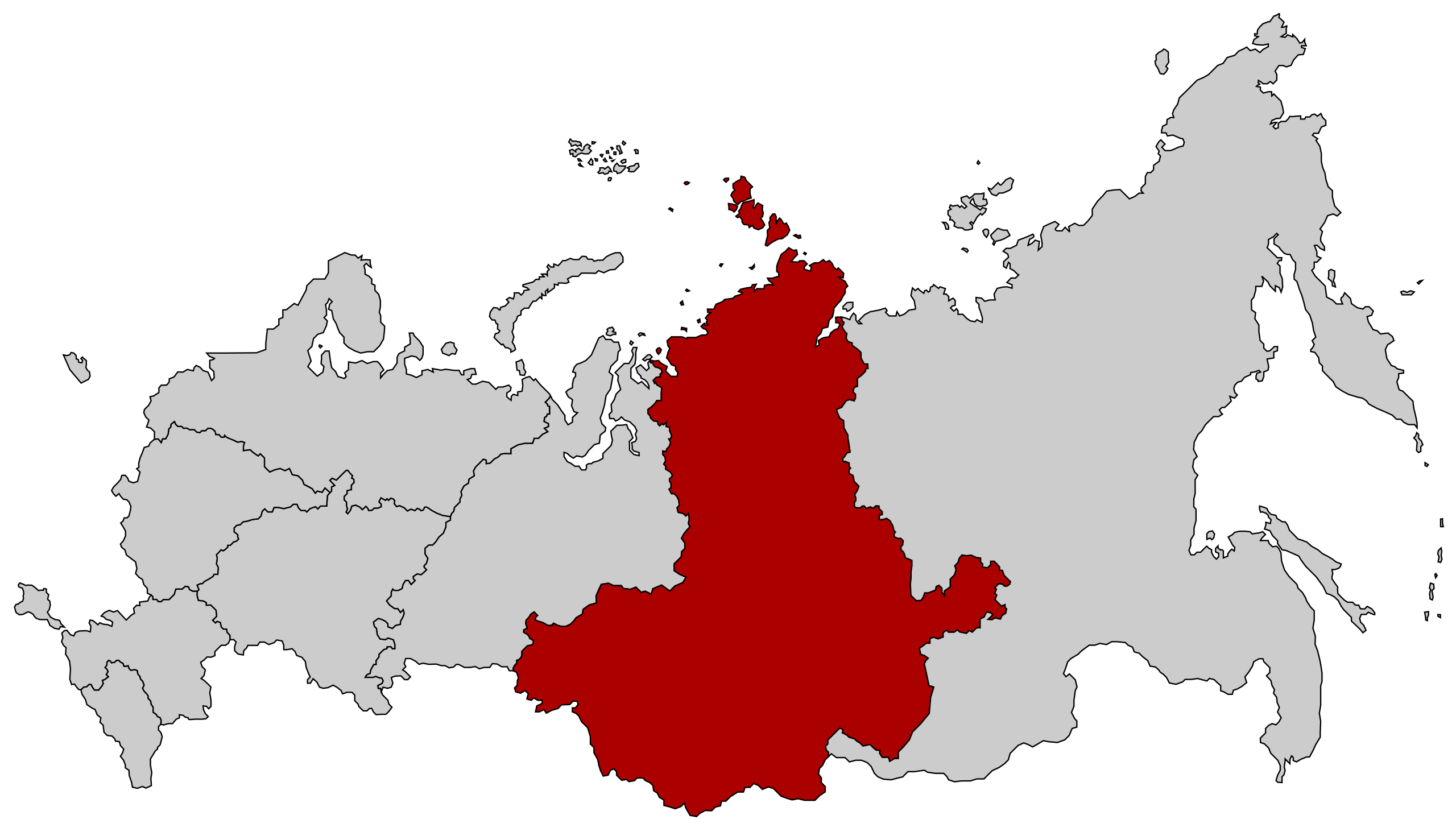
English: Map Russia highlighting the Siberian Federal districts as of 2018-11-03. Español: Ubicación del Distrito Federal de Siberia en la Federación Rusa قالب:Country data Сибирский федеральный округ
English: Map of Russian federal districts, as of 2016-11-04
|
| ⧼wm-license-information-date⧽ | 2018 |
| ⧼wm-license-information-source⧽ | قالب:Derived from |
| ⧼wm-license-information-author⧽ |
| [This is a retouched picture, which means that it has been digitally altered from its original version. Modifications: Removed Buryatia and Zabaykalsky Krai. The original can be viewed here: Map of Russian districts, 2018-11-04.svg. Modifications made by Seryo93.] Error: {{Lang}}: text has italic markup (help)
|
ترخيص
قالب:Original upload log
This image is a derivative work of the following images:
- File:Map of Russia - Siberian Federal District.svg licensed with Cc-by-sa-2.5
- 2015-03-10T14:20:17Z Knyaz-1988 1092x630 (97464 Bytes) Reverted to version as of 22:16, 3 November 2014
- 2014-11-04T01:32:14Z Fry1989 1092x630 (120528 Bytes) NPOV issue.
- 2014-11-03T22:16:30Z Knyaz-1988 1092x630 (97464 Bytes) New version
- 2010-01-21T22:27:35Z Denhud 1092x630 (120528 Bytes) On 2010-01-19 Southern Federal District split in two, with its former southern territories forming new North Caucasian Federal District.
- 2008-03-03T23:36:52Z Lokal Profil 1092x630 (114976 Bytes) {{Information |Description=Map Russia highlighting the Siberian [[:en:Federal districts of Russia|Federal districts]]. |Source=Based on [[:Image:Map of Russian subjects, 2008-03-01.svg|Map of Russian subjects, 2008-03-01.svg]
- File:Map of Russian districts, 2018-11-04.svg licensed with Cc-by-sa-2.5
تاريخ الملف
اضغط على زمن/تاريخ لرؤية الملف كما بدا في هذا الزمن.
| زمن/تاريخ | صورة مصغرة | الأبعاد | مستخدم | تعليق | |
|---|---|---|---|---|---|
| حالي | ★ مراجعة معتمدة 21:03، 3 ديسمبر 2023 | | 1٬092 × 630 (61 كيلوبايت) | Pastakhov (نقاش | مساهمات) | Upload https://upload.wikimedia.org/wikipedia/commons/4/4e/Map_of_Russia_-_Siberian_Federal_District_%282018_composition%29.svg |
لا يمكنك استبدال هذا الملف.
وصلات
لا يوجد صفحات تصل لهذه الصورة.
.svg&oldid=3680219)