ملف:Map of Michigan highlighting Keweenaw County.svg

حجم معاينة PNG لذلك الملف ذي الامتداد SVG: 512 × 599 بكسل. البعد الآخر: 1٬749 × 2٬048 بكسل.
الملف الأصلي (ملف SVG، أبعاده 6٬256 × 7٬325 بكسل، حجم الملف: 205 كيلوبايت)
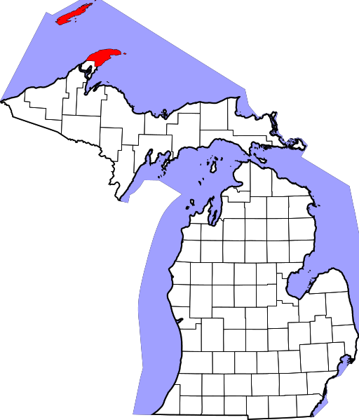
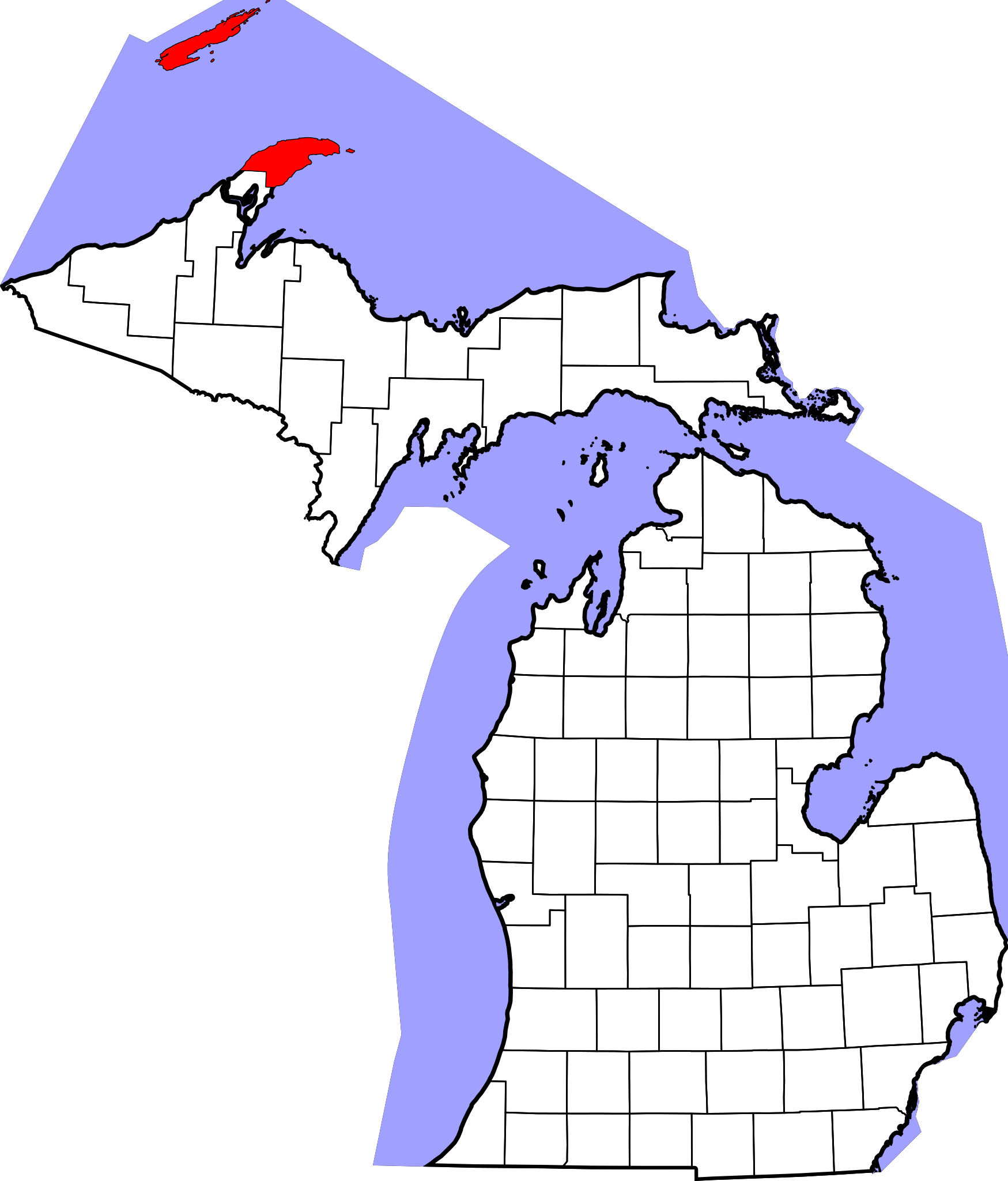
- Locator map showing Keweenaw County in Upper Michigan.
David Benbennick made this map. For more information, see Commons:United States county locator maps.
تاريخ الملف
اضغط على زمن/تاريخ لرؤية الملف كما بدا في هذا الزمن.
| زمن/تاريخ | صورة مصغرة | الأبعاد | مستخدم | تعليق | |
|---|---|---|---|---|---|
| حالي | ★ مراجعة معتمدة 11:45، 23 نوفمبر 2023 | | 6٬256 × 7٬325 (205 كيلوبايت) | Pastakhov (نقاش | مساهمات) | Upload https://upload.wikimedia.org/wikipedia/commons/3/31/Map_of_Michigan_highlighting_Keweenaw_County.svg |
لا يمكنك استبدال هذا الملف.
وصلات
لا يوجد صفحات تصل لهذه الصورة.