ملف:Map of Iberville Parish Louisiana With Municipal Labels.PNG
لا توجد دقة أعلى متوفرة.
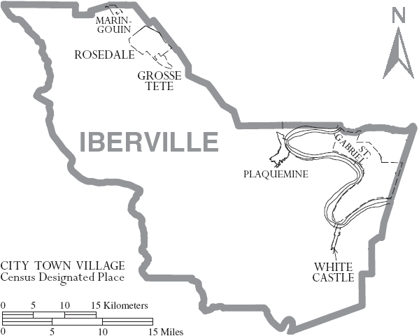
Map_of_Iberville_Parish_Louisiana_With_Municipal_Labels.PNG (599 × 481 بكسل حجم الملف: 33 كيلوبايت، نوع MIME: image/png)
وصف قصير
| ⧼wm-license-information-description⧽ |
Map of Iberville Parish, Louisiana, United States with municipal boundaries |
| ⧼wm-license-information-date⧽ | 2007 |
| ⧼wm-license-information-source⧽ | taken from US Census website [1] and modified by User:Ruhrfisch |
| ⧼wm-license-information-author⧽ | US Census, Ruhrfisch |
| ⧼wm-license-information-permission⧽ (⧼wm-license-information-permission-reusing-text⧽) |
US Census / US Government work is public domain, my modifications licensed under the GNU Free Documentation License |
| ⧼wm-license-information-other-versions⧽ |
Image:Map of Iberville Parish Louisiana With Municipal and District Labels.PNG with district boundaries |
ترخيص
|

تاريخ الملف
اضغط على زمن/تاريخ لرؤية الملف كما بدا في هذا الزمن.
| زمن/تاريخ | صورة مصغرة | الأبعاد | مستخدم | تعليق | |
|---|---|---|---|---|---|
| حالي | ★ مراجعة معتمدة 03:29، 31 أكتوبر 2023 | | 599 × 481 (33 كيلوبايت) | Pastakhov (نقاش | مساهمات) | Upload https://upload.wikimedia.org/wikipedia/commons/4/43/Map_of_Iberville_Parish_Louisiana_With_Municipal_Labels.PNG |
لا يمكنك استبدال هذا الملف.
وصلات
لا يوجد صفحات تصل لهذه الصورة.