ملف:Map of Halaib Triangle-He.jpg

حجم هذه المعاينة: 723 × 599 بكسل. البعد الآخر: 1٬439 × 1٬193 بكسل.
الملف الأصلي (1٬439 × 1٬193 بكسل حجم الملف: 376 كيلوبايت، نوع MIME: image/jpeg)
وصف قصير
| ⧼wm-license-information-description⧽ |
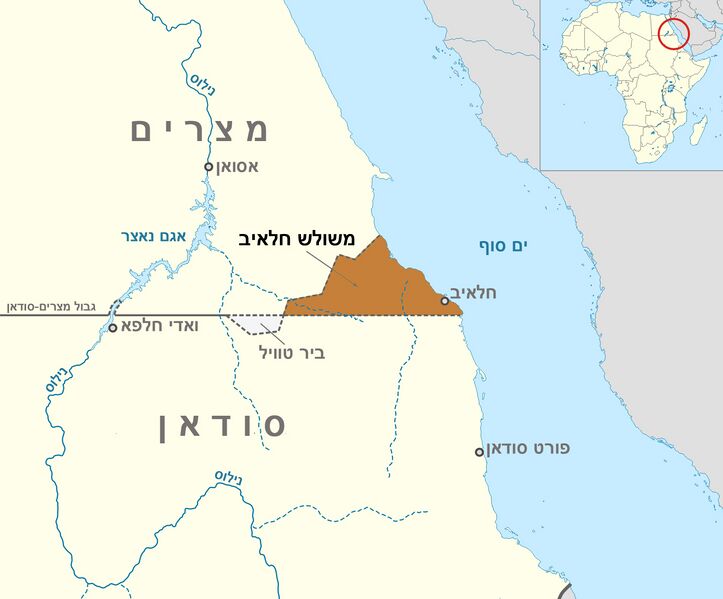
English: Map of Halaib Triangle between Egypt and Sudan
|
| ⧼wm-license-information-date⧽ | 2011-10-20 09:20 (UTC) |
| ⧼wm-license-information-source⧽ | |
| ⧼wm-license-information-author⧽ |
|
| ⧼wm-license-information-other-versions⧽ |
|


| [This is a retouched picture, which means that it has been digitally altered from its original version. Modifications: Hebrew. The original can be viewed here: Map_of_Halaib_Triangle-en.png. Modifications made by Itzuvit.] Error: {{Lang}}: text has italic markup (help)
|
ترخيص
|

قالب:Original upload log
This image is a derivative work of the following images:
- File:Map_of_Halaib_Triangle-en.png licensed with Cc-by-sa-3.0, GFDL
- 2011-01-12T17:37:25Z Пакко 1439x1193 (224410 Bytes) {{Information |Description={{en|1=Map of Halaib Triangle between Egypt and Sudan}} |Source={{own}} |Author=[[User:Пакко|Пакко]] |Date=2010-01-12 |Permission= |other_versions= }} [[Category:Disputed territories]] [[
تاريخ الملف
اضغط على زمن/تاريخ لرؤية الملف كما بدا في هذا الزمن.
| زمن/تاريخ | صورة مصغرة | الأبعاد | مستخدم | تعليق | |
|---|---|---|---|---|---|
| حالي | ★ مراجعة معتمدة 10:21، 6 نوفمبر 2023 | | 1٬439 × 1٬193 (376 كيلوبايت) | Pastakhov (نقاش | مساهمات) | Upload https://upload.wikimedia.org/wikipedia/commons/e/e2/Map_of_Halaib_Triangle-He.jpg |
لا يمكنك استبدال هذا الملف.
وصلات
الصفحات التالية تحتوي على وصلة لهذه الصورة: