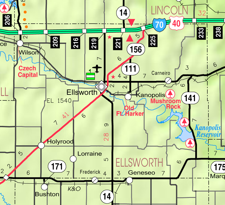
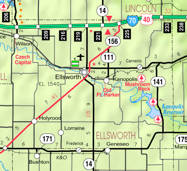
ملف:Map of Ellsworth Co, Ks, USA.png
حجم هذه المعاينة: 656 × 599 بكسل. البعد الآخر: 854 × 780 بكسل.
الملف الأصلي (854 × 780 بكسل حجم الملف: 253 كيلوبايت، نوع MIME: image/png)
وصف قصير
| ⧼wm-license-information-description⧽ |
This map of Ellsworth County, Kansas, USA, is copied at a resolution of 300 pixels/inch from the original PDF file. |
| ⧼wm-license-information-date⧽ | 2005 |
| ⧼wm-license-information-source⧽ | Kansas 2005–2006 Official Transportation Map [1] (map legend) |
| ⧼wm-license-information-author⧽ | Designed and published by the Kansas Department of Transportation. |
| ⧼wm-license-information-permission⧽ (⧼wm-license-information-permission-reusing-text⧽) |
ترخيص
|
|
This work has been released into the public domain by its author, Kansas Department of Transportation. This applies worldwide. In case this is not legally possible: |
This map is published by the Kansas Department of Transportation and is distributed to the public free of charge. KDOT makes no warranties, guarantees, or representations for accuracy of this information and assumes no liability for errors or omissions. Maps produced using tax payer dollars are free for public use.
تاريخ الملف
اضغط على زمن/تاريخ لرؤية الملف كما بدا في هذا الزمن.
| زمن/تاريخ | صورة مصغرة | الأبعاد | مستخدم | تعليق | |
|---|---|---|---|---|---|
| حالي | ★ مراجعة معتمدة 15:27، 22 يناير 2024 | | 854 × 780 (253 كيلوبايت) | Pastakhov (نقاش | مساهمات) | Upload https://upload.wikimedia.org/wikipedia/commons/c/cf/Map_of_Ellsworth_Co%2C_Ks%2C_USA.png |
لا يمكنك استبدال هذا الملف.
وصلات
لا يوجد صفحات تصل لهذه الصورة.