ملف:Map of Ebola Outbreak - 1 October 2014.svg

حجم معاينة PNG لذلك الملف ذي الامتداد SVG: 800 × 489 بكسل. البعد الآخر: 2٬560 × 1٬566 بكسل.
الملف الأصلي (ملف SVG، أبعاده 1٬636 × 1٬001 بكسل، حجم الملف: 5٫37 ميجابايت)
وصف قصير
قالب:Uploaded with en.wp UW marker
| ⧼wm-license-information-description⧽ |
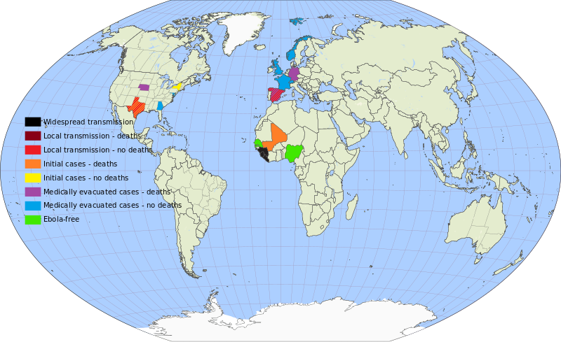
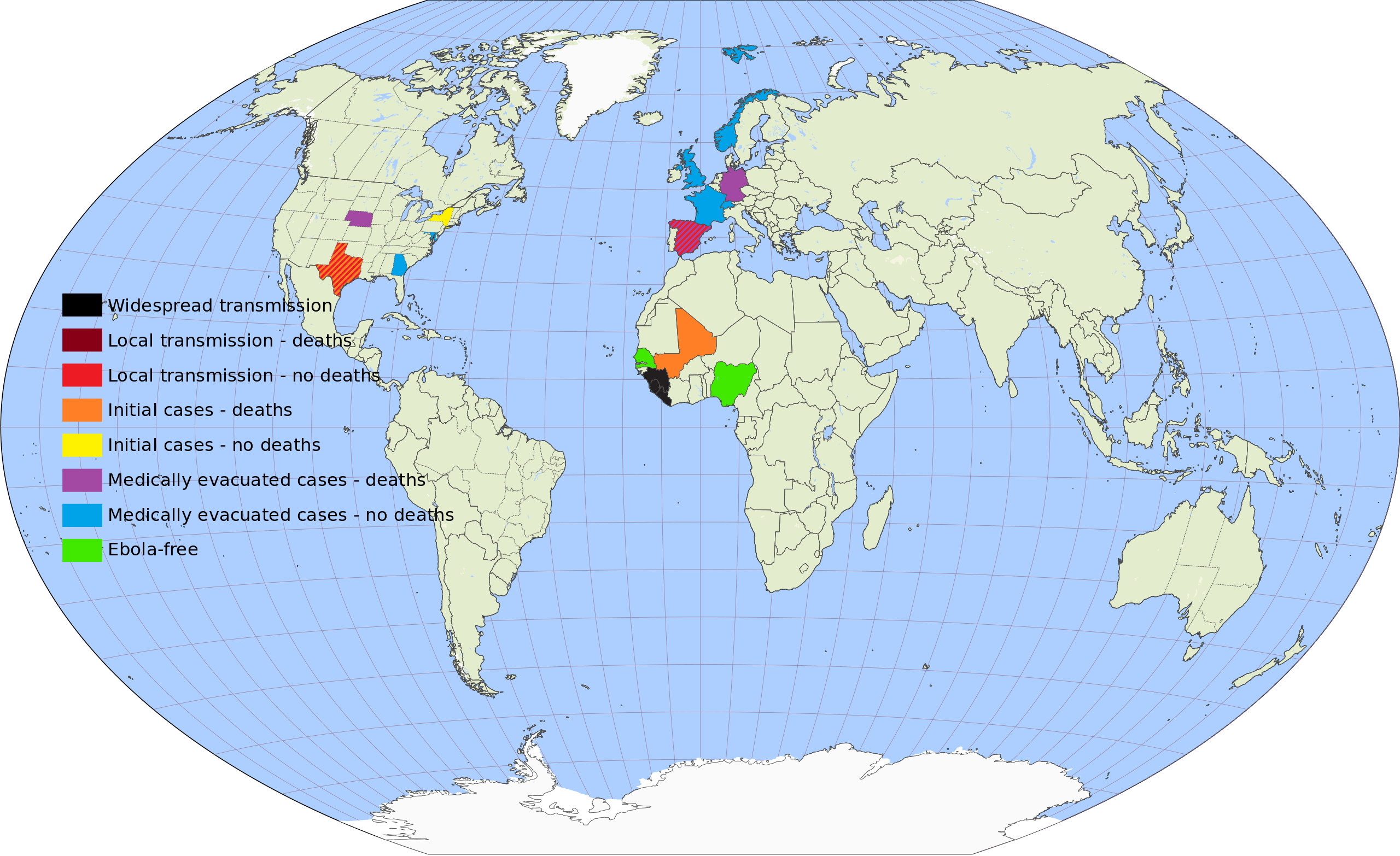
English: The locations currently affected by the West Africa Ebola Outbreak.
(Finnish) (مجرية) Deutsch: Von der Ebolafieber-Epidemie 2014 betroffene Länder.
|
| ⧼wm-license-information-date⧽ | 2014 |
| ⧼wm-license-information-source⧽ | Created with tools from Kartograph, released under the AGPL license. |
| ⧼wm-license-information-author⧽ | AmericanXplorer13 |
ترخيص
|

تاريخ الملف
اضغط على زمن/تاريخ لرؤية الملف كما بدا في هذا الزمن.
| زمن/تاريخ | صورة مصغرة | الأبعاد | مستخدم | تعليق | |
|---|---|---|---|---|---|
| حالي | ★ مراجعة معتمدة 05:29، 16 ديسمبر 2023 | | 1٬636 × 1٬001 (5٫37 ميجابايت) | Pastakhov (نقاش | مساهمات) | Upload https://upload.wikimedia.org/wikipedia/commons/f/fd/Map_of_Ebola_Outbreak_-_1_October_2014.svg |
لا يمكنك استبدال هذا الملف.
وصلات
لا يوجد صفحات تصل لهذه الصورة.