ملف:Map of Churches of Moldavia in Suceava Country.jpg
حجم هذه المعاينة: 800 × 544 بكسل. البعدان الآخران: 2٬560 × 1٬741 بكسل | 5٬200 × 3٬536 بكسل.
الملف الأصلي (5٬200 × 3٬536 بكسل حجم الملف: 864 كيلوبايت، نوع MIME: image/jpeg)
وصف قصير
| ⧼wm-license-information-description⧽ |
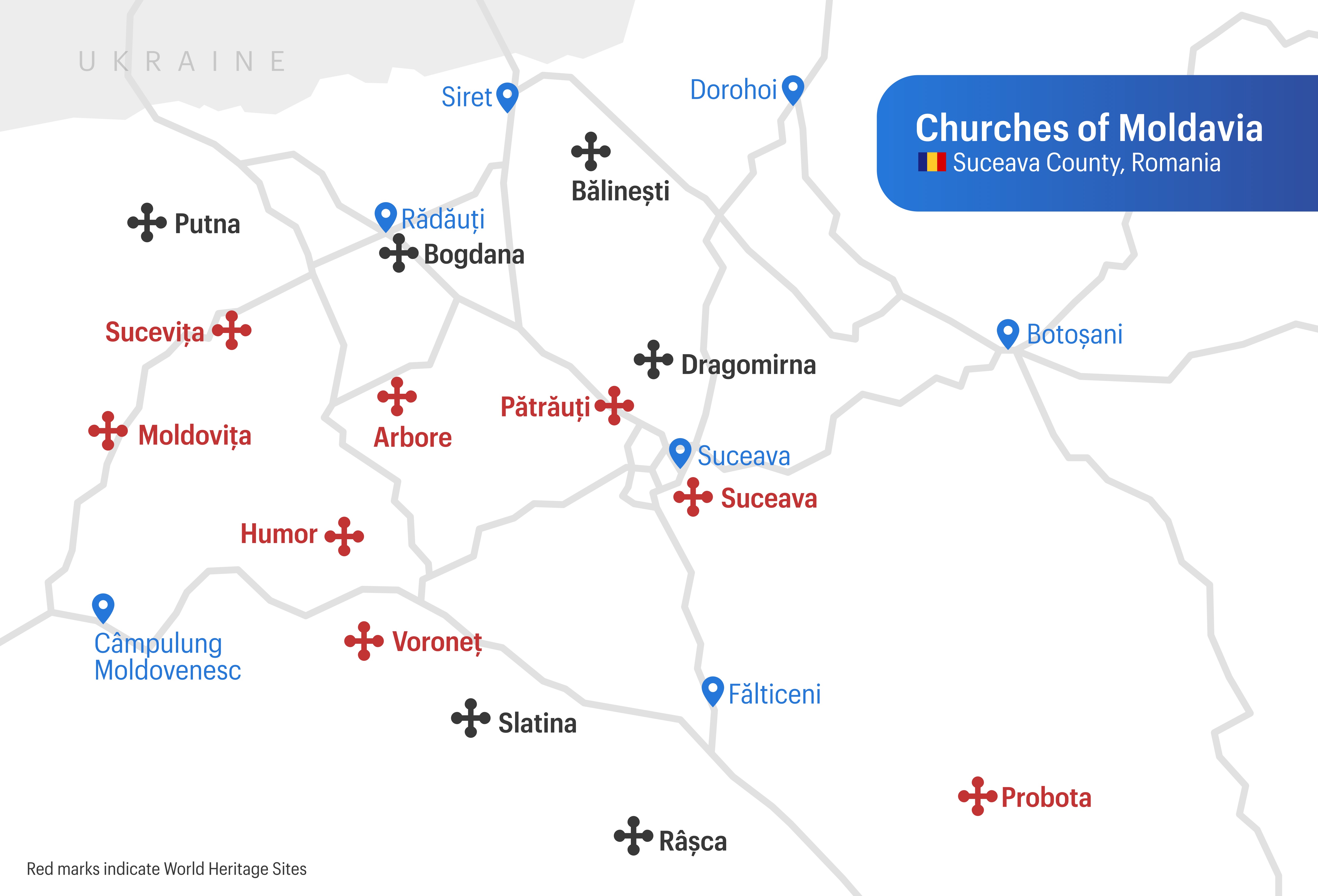
English: Map of historical monasteries in Suceava county
- World Heritage Sites are marked in red. - national highways are shown in grey lines. - Marked towns are shown in blue. This map is based of data from the OpenStreet Maps and information derived from ملف:Map of monasteries in Suceava County.jpg file:Map of monasteries in Suceava County.jpg by Meichs. |
| ⧼wm-license-information-date⧽ | 2023 |
| ⧼wm-license-information-source⧽ | ⧼Wm-license-own-work⧽ |
| ⧼wm-license-information-author⧽ | Chainwit. |
ترخيص
تاريخ الملف
اضغط على زمن/تاريخ لرؤية الملف كما بدا في هذا الزمن.
| زمن/تاريخ | صورة مصغرة | الأبعاد | مستخدم | تعليق | |
|---|---|---|---|---|---|
| حالي | ★ مراجعة معتمدة 13:47، 27 أكتوبر 2023 | | 5٬200 × 3٬536 (864 كيلوبايت) | Pastakhov (نقاش | مساهمات) | Upload https://upload.wikimedia.org/wikipedia/commons/6/62/Map_of_Churches_of_Moldavia_in_Suceava_Country.jpg |
لا يمكنك استبدال هذا الملف.
وصلات
لا يوجد صفحات تصل لهذه الصورة.