ملف:Map at woerthersee.svg

حجم معاينة PNG لذلك الملف ذي الامتداد SVG: 800 × 453 بكسل. البعد الآخر: 2٬560 × 1٬451 بكسل.
الملف الأصلي (ملف SVG، أبعاده 1٬313 × 744 بكسل، حجم الملف: 343 كيلوبايت)
| ⧼wm-license-information-description⧽ |
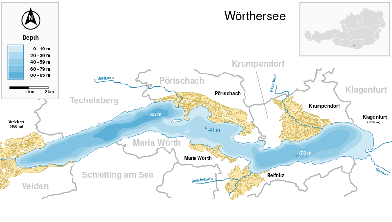
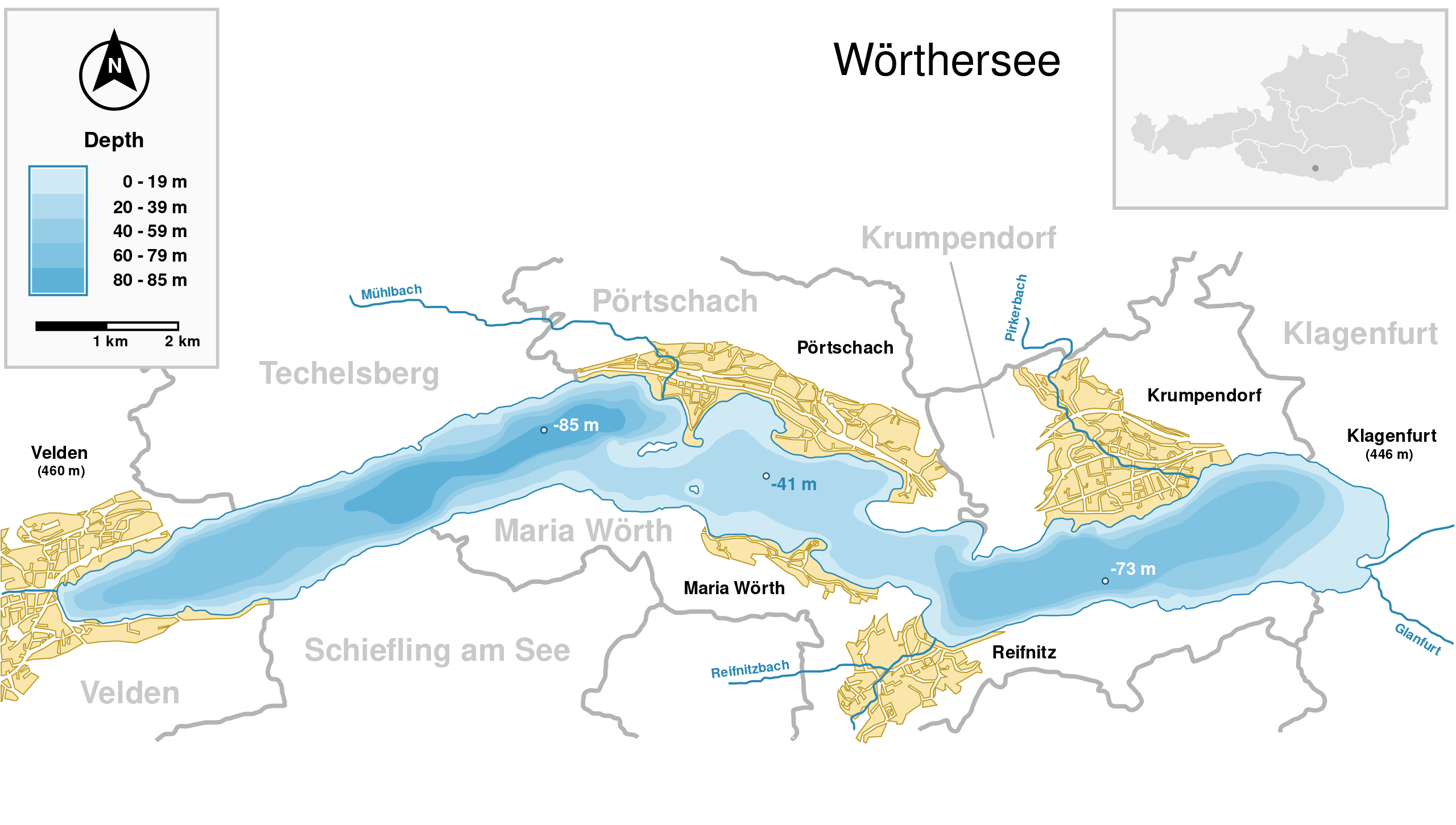
Deutsch: Wörthersee (Kärnten, Österreich) und wichtigste Ortschaften. English: Wörthersee (Carinthia, Austria) with surrounding towns.
|
| ⧼wm-license-information-date⧽ | 2008 |
| ⧼wm-license-information-source⧽ | |
| ⧼wm-license-information-author⧽ | Michael Glanznig (Mglanznig) |
| ⧼wm-license-information-permission⧽ (⧼wm-license-information-permission-reusing-text⧽) |
Creative Commons Attribution ShareAlike 2.0 Austria |
46°37′22.8″N 14°9′34.7″E / 46.623000°N 14.159639°E
تاريخ الملف
اضغط على زمن/تاريخ لرؤية الملف كما بدا في هذا الزمن.
| زمن/تاريخ | صورة مصغرة | الأبعاد | مستخدم | تعليق | |
|---|---|---|---|---|---|
| حالي | ★ مراجعة معتمدة 00:18، 14 أكتوبر 2023 | | 1٬313 × 744 (343 كيلوبايت) | Pastakhov (نقاش | مساهمات) | Upload https://upload.wikimedia.org/wikipedia/commons/8/8c/Map_at_woerthersee.svg |
لا يمكنك استبدال هذا الملف.
وصلات
الصفحات التالية تحتوي على وصلة لهذه الصورة: