ملف:Map Karlskrona Sweden.jpg
حجم هذه المعاينة: 401 × 599 بكسل. البعد الآخر: 1٬989 × 2٬972 بكسل.
الملف الأصلي (1٬989 × 2٬972 بكسل حجم الملف: 7٫44 ميجابايت، نوع MIME: image/jpeg)
وصف قصير
| ⧼wm-license-information-description⧽ |
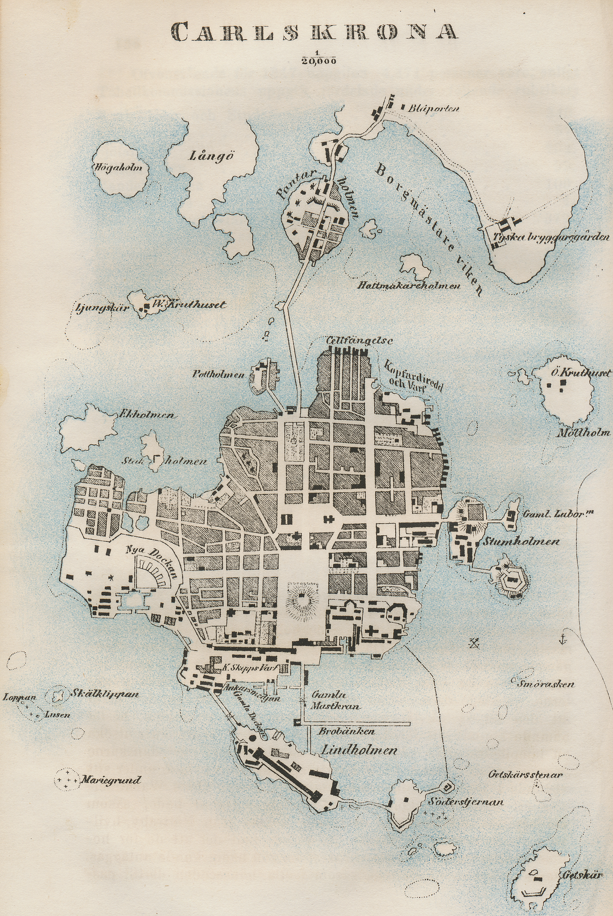
English: Map from about 1850 of the town of Karlskrona in Sweden.
|
| ⧼wm-license-information-date⧽ | 1850 |
| ⧼wm-license-information-source⧽ | Old printed map in my possession. |
| ⧼wm-license-information-author⧽ | Sven Rosborn |
ترخيص
|

تاريخ الملف
اضغط على زمن/تاريخ لرؤية الملف كما بدا في هذا الزمن.
| زمن/تاريخ | صورة مصغرة | الأبعاد | مستخدم | تعليق | |
|---|---|---|---|---|---|
| حالي | ★ مراجعة معتمدة 00:37، 15 ديسمبر 2023 | | 1٬989 × 2٬972 (7٫44 ميجابايت) | Pastakhov (نقاش | مساهمات) | Upload https://upload.wikimedia.org/wikipedia/commons/0/0a/Map_Karlskrona_Sweden.jpg |
لا يمكنك استبدال هذا الملف.
وصلات
لا يوجد صفحات تصل لهذه الصورة.