ملف:Map Burgundian Kingdom-es.svg

حجم معاينة PNG لذلك الملف ذي الامتداد SVG: 592 × 599 بكسل. البعد الآخر: 2٬024 × 2٬048 بكسل.
الملف الأصلي (ملف SVG، أبعاده 1٬002 × 1٬014 بكسل، حجم الملف: 245 كيلوبايت)
وصف قصير
| ⧼wm-license-information-description⧽ |
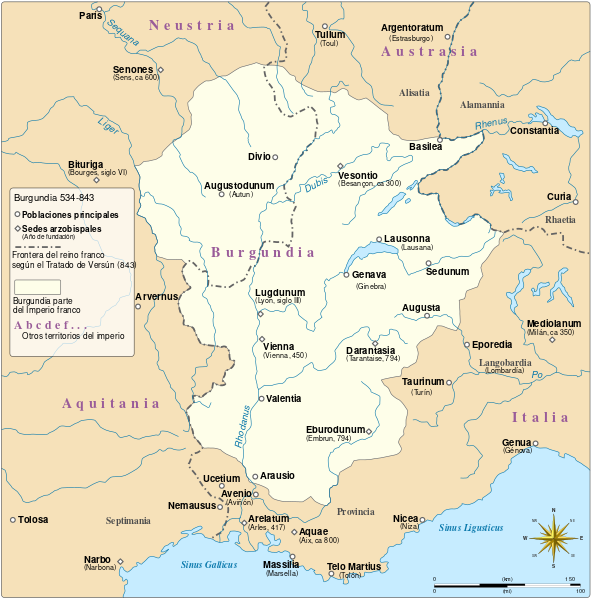
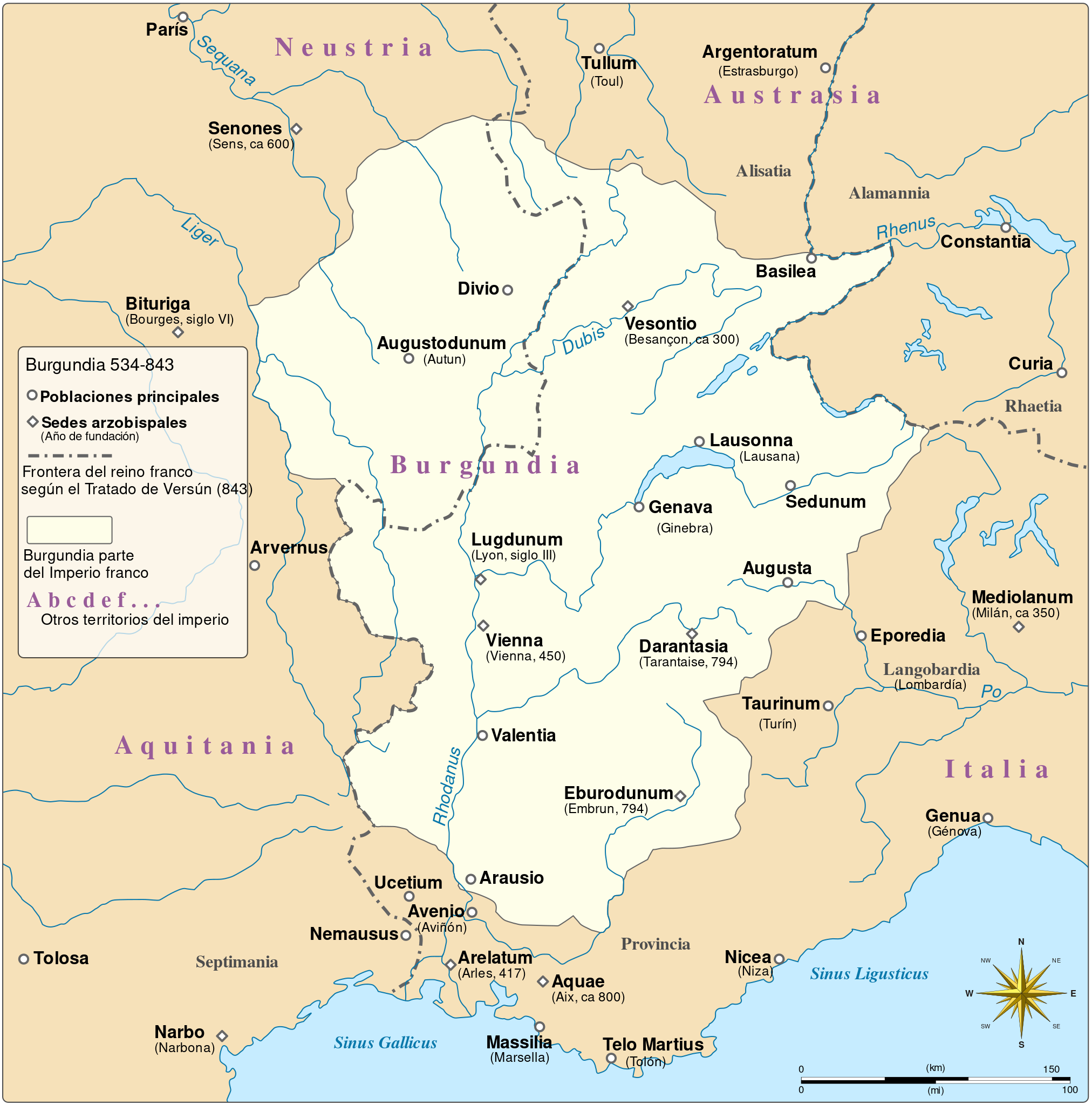
English: Burgundy as a part of the Frankish Empire between 534 and the division of the Frankish realm by the Treaty of Verdun, 843 Español: Burgundia como parte del Imperio franco, entre el 534 y la división del imperio en el Tratado de Verdún del 843.
|
| ⧼wm-license-information-date⧽ | 2015 |
| ⧼wm-license-information-source⧽ | قالب:F |
| ⧼wm-license-information-author⧽ |
ترخيص
|
تاريخ الملف
اضغط على زمن/تاريخ لرؤية الملف كما بدا في هذا الزمن.
| زمن/تاريخ | صورة مصغرة | الأبعاد | مستخدم | تعليق | |
|---|---|---|---|---|---|
| حالي | ★ مراجعة معتمدة 01:27، 13 ديسمبر 2023 | | 1٬002 × 1٬014 (245 كيلوبايت) | Pastakhov (نقاش | مساهمات) | Upload https://upload.wikimedia.org/wikipedia/commons/8/85/Map_Burgundian_Kingdom-es.svg |
لا يمكنك استبدال هذا الملف.
وصلات
لا يوجد صفحات تصل لهذه الصورة.