ملف:Manchester from the air (geograph 6532147).jpg

حجم هذه المعاينة: 800 × 600 بكسل. البعد الآخر: 1٬024 × 768 بكسل.
الملف الأصلي (1٬024 × 768 بكسل حجم الملف: 540 كيلوبايت، نوع MIME: image/jpeg)
وصف قصير
| ⧼wm-license-information-description⧽ |
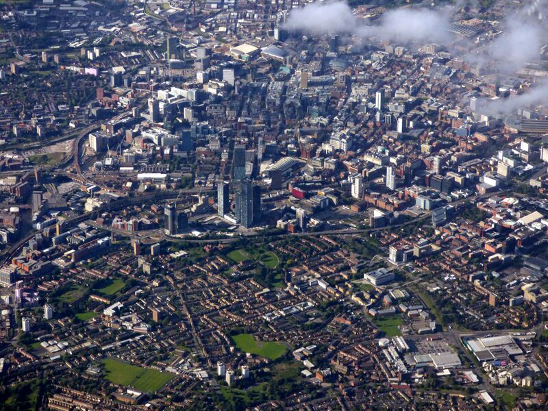
English: Manchester from the air. Looking over Hulme towards the city centre from above Northenden (4 miles south) from a Prague bound flight from Manchester. The A57(M) road marks the clear boundary between city and suburb.
|
| ⧼wm-license-information-date⧽ | 2020 |
| ⧼wm-license-information-source⧽ | From geograph.org.uk |
| ⧼wm-license-information-author⧽ | Thomas Nugent |
| ⧼wm-license-information-permission⧽ (⧼wm-license-information-permission-reusing-text⧽) |
Creative Commons Attribution Share-alike license 2.0 |
| ⧼wm-license-cc-attribution⧽ (قالب:I18n/Credit line) |
Thomas Nugent / Manchester from the air / |
ترخيص
تاريخ الملف
اضغط على زمن/تاريخ لرؤية الملف كما بدا في هذا الزمن.
| زمن/تاريخ | صورة مصغرة | الأبعاد | مستخدم | تعليق | |
|---|---|---|---|---|---|
| حالي | ★ مراجعة معتمدة 09:04، 23 نوفمبر 2023 | | 1٬024 × 768 (540 كيلوبايت) | Pastakhov (نقاش | مساهمات) | Upload https://upload.wikimedia.org/wikipedia/commons/5/5c/Manchester_from_the_air_%28geograph_6532147%29.jpg |
لا يمكنك استبدال هذا الملف.
وصلات
لا يوجد صفحات تصل لهذه الصورة.
.jpg&oldid=3574858)