ملف:Manchester Wards Map (2022).svg

حجم معاينة PNG لذلك الملف ذي الامتداد SVG: 330 × 599 بكسل. البعد الآخر: 1٬128 × 2٬048 بكسل.
الملف الأصلي (ملف SVG، أبعاده 512 × 929 بكسل، حجم الملف: 65 كيلوبايت)
وصف قصير
| ⧼wm-license-information-description⧽ |
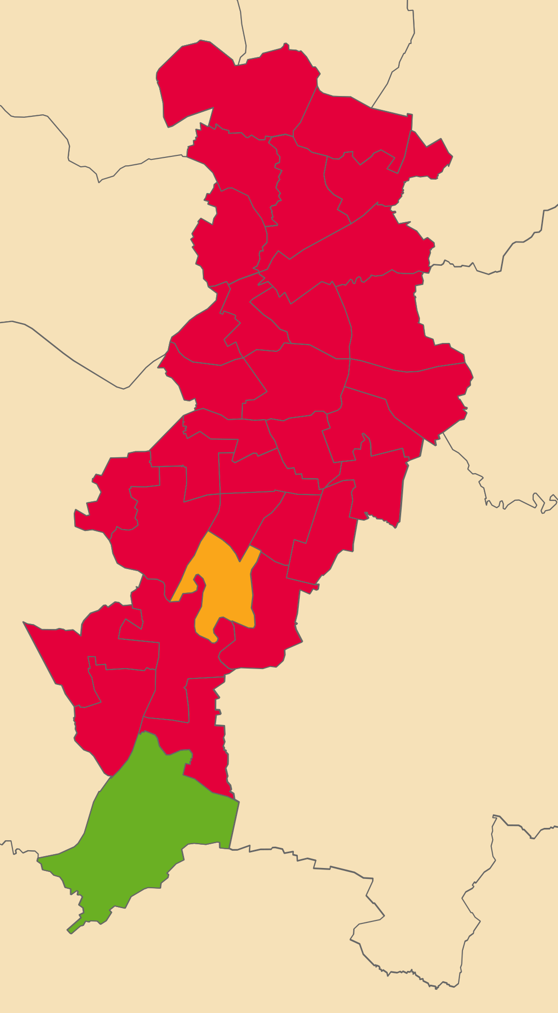
English: A map displaying all electoral wards in Manchester, updated for post-2018 boundaries. Shows results for May 2022 Local Elections in Manchester - Red for Labour, Green for the Green Party and Orange for the Liberal Democrats
|
| ⧼wm-license-information-date⧽ | 2022 |
| ⧼wm-license-information-source⧽ | Image created by self, all data sourced is from below:
Local Authority Boundaries: https://geoportal.statistics.gov.uk/search?collection=Dataset&sort=name&tags=all(BDY_CTYUA%2CDEC_2021) Manchester Ward Boundaries: https://geoportal.statistics.gov.uk/maps/wards-december-2021-gb-bgc Source: Office for National Statistics licensed under the Open Government Licence v.3.0 Contains OS data © Crown copyright and database right [2022] |
| ⧼wm-license-information-author⧽ | User:George.J.M01, created using Ordnance Survey data |
ترخيص
تاريخ الملف
اضغط على زمن/تاريخ لرؤية الملف كما بدا في هذا الزمن.
| زمن/تاريخ | صورة مصغرة | الأبعاد | مستخدم | تعليق | |
|---|---|---|---|---|---|
| حالي | ★ مراجعة معتمدة 08:16، 20 نوفمبر 2023 | | 512 × 929 (65 كيلوبايت) | Pastakhov (نقاش | مساهمات) | Upload https://upload.wikimedia.org/wikipedia/commons/a/a7/Manchester_Wards_Map_%282022%29.svg |
لا يمكنك استبدال هذا الملف.
وصلات
لا يوجد صفحات تصل لهذه الصورة.
.svg&oldid=3561304)