ملف:Main Street, Catthorpe - geograph.org.uk - 657331.jpg
لا توجد دقة أعلى متوفرة.
Main_Street,_Catthorpe_-_geograph.org.uk_-_657331.jpg (640 × 428 بكسل حجم الملف: 117 كيلوبايت، نوع MIME: image/jpeg)
وصف قصير
| ⧼wm-license-information-description⧽ |
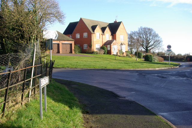
English: Main Street, Catthorpe This was once the main road between Rugby and Market Harborough; it has now been declassified with signposting firmly discouraging long-distance traffic, leaving Catthorpe as a sleepy backwater. The lane to the right leads to Lilbourne past the site of the long-closed Lilbourne station.
|
| ⧼wm-license-information-date⧽ | 2008 |
| ⧼wm-license-information-source⧽ | From geograph.org.uk |
| ⧼wm-license-information-author⧽ | Stephen McKay |
| ⧼wm-license-cc-attribution⧽ (قالب:I18n/Credit line) |
Stephen McKay / Main Street, Catthorpe / |
52°23′54″N 1°11′21″W / 52.39836°N 1.1892°W قالب:Object location
_heading:90)
ترخيص
تاريخ الملف
اضغط على زمن/تاريخ لرؤية الملف كما بدا في هذا الزمن.
| زمن/تاريخ | صورة مصغرة | الأبعاد | مستخدم | تعليق | |
|---|---|---|---|---|---|
| حالي | ★ مراجعة معتمدة 15:10، 8 نوفمبر 2023 | | 640 × 428 (117 كيلوبايت) | Pastakhov (نقاش | مساهمات) | Upload https://upload.wikimedia.org/wikipedia/commons/7/76/Main_Street%2C_Catthorpe_-_geograph.org.uk_-_657331.jpg |
لا يمكنك استبدال هذا الملف.
وصلات
لا يوجد صفحات تصل لهذه الصورة.