ملف:MachiasBay1776.png
حجم هذه المعاينة: 478 × 600 بكسل. البعد الآخر: 600 × 753 بكسل.
الملف الأصلي (600 × 753 بكسل حجم الملف: 633 كيلوبايت، نوع MIME: image/png)
وصف قصير
| ⧼wm-license-information-description⧽ |
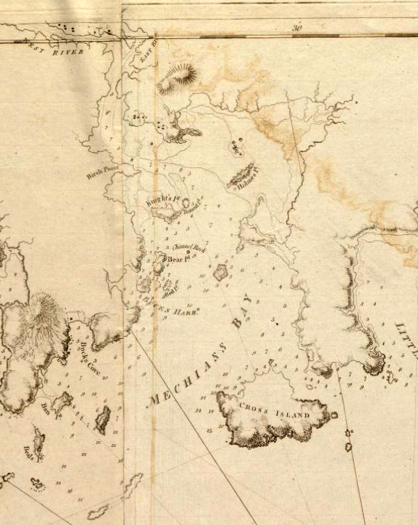
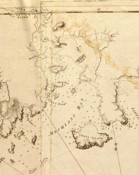
English: This is a detail of the source, which is a nautical chart captioned Coast of Maine from Moose Cove to Gouldsboro Bay. This detail shows only Machias Bay. The community of Machias is just visible at the top of the map.
|
| ⧼wm-license-information-date⧽ | 1776 |
| ⧼wm-license-information-source⧽ | From the Boston Public Library Digital Map collection (maps.bpl.org).
Call Number: G1106.P5 1777 .D4 URL at time of upload: http://maps.bpl.org/details_12641/ |
| ⧼wm-license-information-author⧽ | Des Barres, Joseph F.W. |
قالب:Works created more than 200 years ago
ترخيص
|
|
This file is in the ملكية عامة because its copyright has expired in the United States and those countries with a copyright term of no more than the life of the author plus 100 years.
|
تاريخ الملف
اضغط على زمن/تاريخ لرؤية الملف كما بدا في هذا الزمن.
| زمن/تاريخ | صورة مصغرة | الأبعاد | مستخدم | تعليق | |
|---|---|---|---|---|---|
| حالي | ★ مراجعة معتمدة 09:53، 13 أكتوبر 2023 | | 600 × 753 (633 كيلوبايت) | Pastakhov (نقاش | مساهمات) | Upload https://upload.wikimedia.org/wikipedia/commons/c/c5/MachiasBay1776.png |
لا يمكنك استبدال هذا الملف.
وصلات
لا يوجد صفحات تصل لهذه الصورة.