ملف:MSTL Map.png
حجم هذه المعاينة: 667 × 600 بكسل. البعد الآخر: 1٬038 × 933 بكسل.
الملف الأصلي (1٬038 × 933 بكسل حجم الملف: 275 كيلوبايت، نوع MIME: image/png)
وصف قصير
| ⧼wm-license-information-description⧽ |
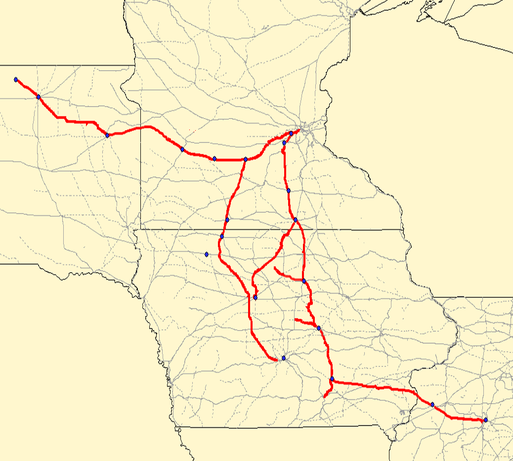
Map of the. Red lines are the MSTL route; gray lines are other railroads. Created using Quantum GIS using data from the Bureau of Transportation Statistics under "Railway Network (1:100,000 base scale)" and queried against the previous railroad of "MSTL". Rechecked against Cash Groth's site and missing/dirty data filled in. |
| ⧼wm-license-information-date⧽ | قالب:Original upload date |
| ⧼wm-license-information-source⧽ | قالب:Transferred from قالب:Created with QGIS |
| ⧼wm-license-information-author⧽ | قالب:User at project |
ترخيص
قالب:Original upload log
قالب:Original description page
- 2006-09-02 04:35 Elkman 1038×933×8 (281134 bytes) Map of the [[Minneapolis and St. Louis Railway]]. Red lines are the MSTL route; gray lines are other railroads. Created using Quantum GIS using data from [http://www.bts.gov/publications/national_transportation_atlas_database/2006/ the Bureau of Transpo
تاريخ الملف
اضغط على زمن/تاريخ لرؤية الملف كما بدا في هذا الزمن.
| زمن/تاريخ | صورة مصغرة | الأبعاد | مستخدم | تعليق | |
|---|---|---|---|---|---|
| حالي | ★ مراجعة معتمدة 18:52، 1 نوفمبر 2023 | | 1٬038 × 933 (275 كيلوبايت) | Pastakhov (نقاش | مساهمات) | Upload https://upload.wikimedia.org/wikipedia/commons/4/48/MSTL_Map.png |
لا يمكنك استبدال هذا الملف.
وصلات
لا يوجد صفحات تصل لهذه الصورة.