ملف:Lyall Street - geograph.org.uk - 1452699.jpg
حجم هذه المعاينة: 450 × 600 بكسل. البعد الآخر: 480 × 640 بكسل.
الملف الأصلي (480 × 640 بكسل حجم الملف: 59 كيلوبايت، نوع MIME: image/jpeg)
وصف قصير
| ⧼wm-license-information-description⧽ |
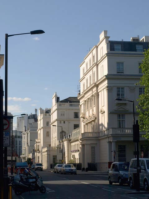
English: Lyall Street The north side of the street, seen here from across Eaton Square, is dominated by blocks forming the ends of terraces on cross roads, including the west side of the square itself and Eaton Place.
|
| ⧼wm-license-information-date⧽ | 2009 |
| ⧼wm-license-information-source⧽ | From geograph.org.uk |
| ⧼wm-license-information-author⧽ | Derek Harper |
| ⧼wm-license-cc-attribution⧽ (قالب:I18n/Credit line) |
Derek Harper / Lyall Street / |
51°29′42″N 0°09′11″W / 51.49489°N 0.1530°W قالب:Object location
_heading:315)
ترخيص
تاريخ الملف
اضغط على زمن/تاريخ لرؤية الملف كما بدا في هذا الزمن.
| زمن/تاريخ | صورة مصغرة | الأبعاد | مستخدم | تعليق | |
|---|---|---|---|---|---|
| حالي | ★ مراجعة معتمدة 01:48، 11 أكتوبر 2023 | | 480 × 640 (59 كيلوبايت) | Pastakhov (نقاش | مساهمات) | Upload https://upload.wikimedia.org/wikipedia/commons/4/4b/Lyall_Street_-_geograph.org.uk_-_1452699.jpg |
لا يمكنك استبدال هذا الملف.
وصلات
لا يوجد صفحات تصل لهذه الصورة.