ملف:LudaLandLease-Territory.png
حجم هذه المعاينة: 688 × 599 بكسل. البعد الآخر: 1٬086 × 946 بكسل.
الملف الأصلي (1٬086 × 946 بكسل حجم الملف: 1٫37 ميجابايت، نوع MIME: image/png)
وصف قصير
| ⧼wm-license-information-description⧽ |
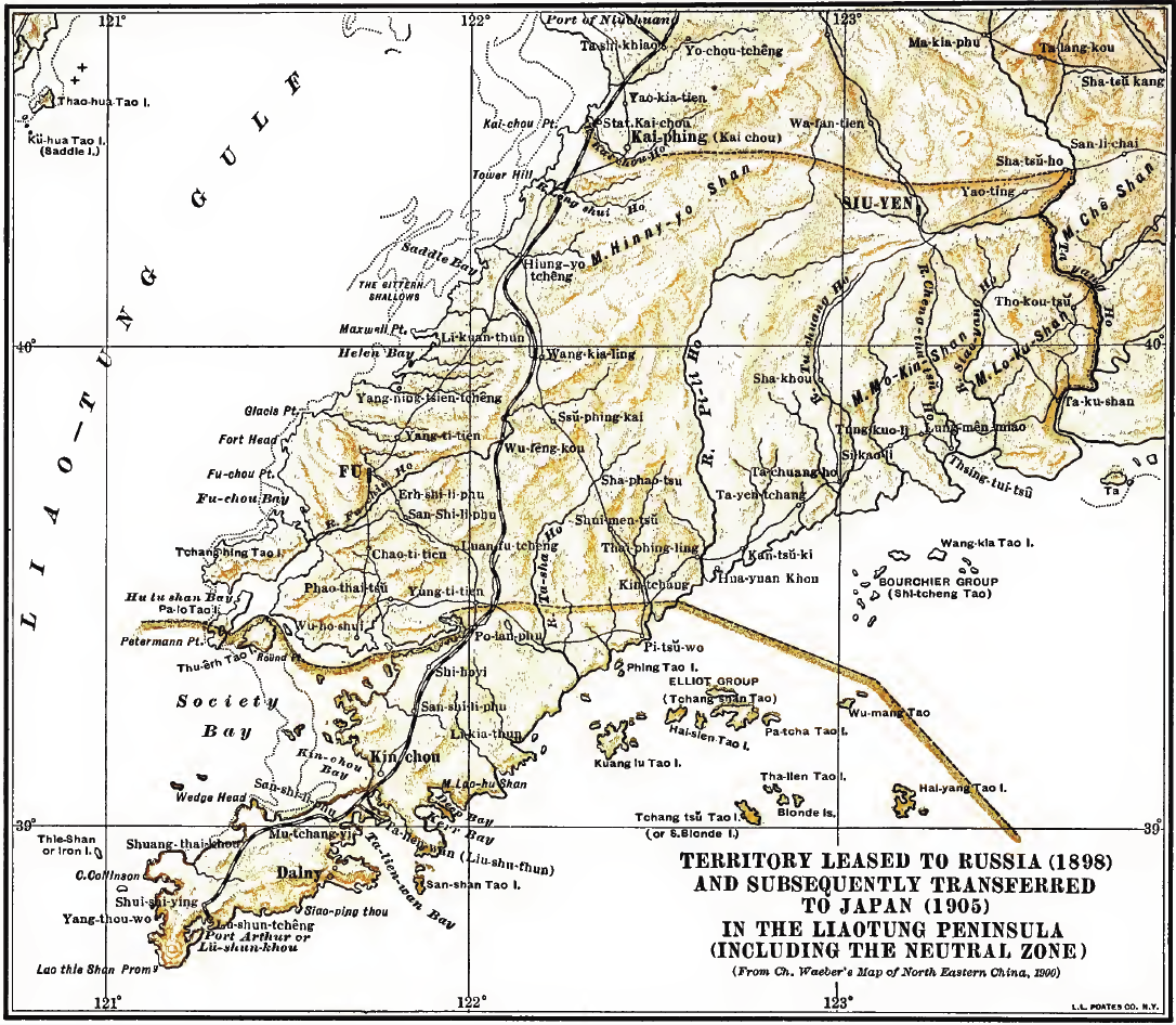
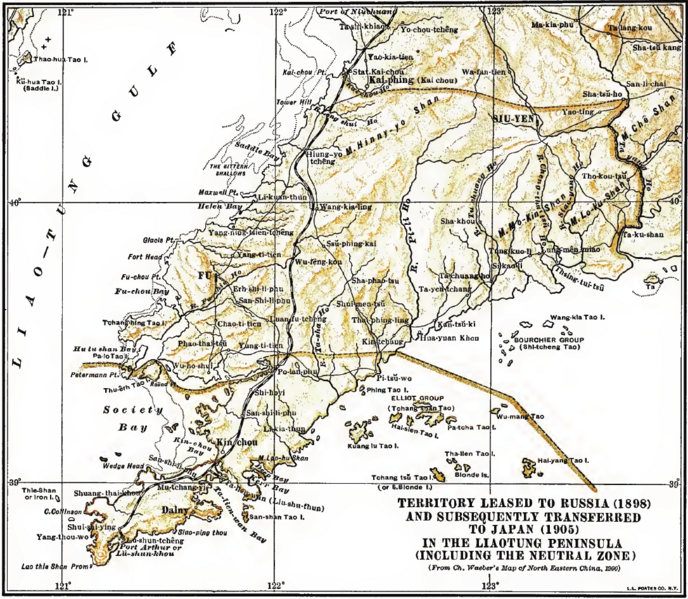
Deutsch: Karte des von Russland 1898 "gepachteten" und 1905 an Japan transferierten Gebietes der Liaodong Halbinsel sowie der neutralen Zone English: Territory Leased to Russia (1898) and subsequently transferred to Japan (1905) in the Liaotung Peninsula (including the neutral zone)
|
| ⧼wm-license-information-date⧽ | 2011 |
| ⧼wm-license-information-source⧽ | used by John V.A. MacMurray in his book "Treaties and Agreements with and concerning China"; as scan archived unter https://archive.org/details/cu31924017545231 |
| ⧼wm-license-information-author⧽ | Original map from "Ch. Waeber's Map of North Eastern China (1900)" |
ترخيص
هذه الصورة هي ضمن الملكية عامة بسبب إنتهاء فترة صلاحية حقوقها في الولايات المتحدة الأمريكية و أي دولة أخرى ينص قانونها على مرور 70 سنة كحد أعلى على وفاة المنتج لإنتهاء صلاحية الحقوق.
تاريخ الملف
اضغط على زمن/تاريخ لرؤية الملف كما بدا في هذا الزمن.
| زمن/تاريخ | صورة مصغرة | الأبعاد | مستخدم | تعليق | |
|---|---|---|---|---|---|
| حالي | ★ مراجعة معتمدة 15:04، 11 أكتوبر 2023 | | 1٬086 × 946 (1٫37 ميجابايت) | Pastakhov (نقاش | مساهمات) | Upload https://upload.wikimedia.org/wikipedia/commons/2/22/LudaLandLease-Territory.png |
لا يمكنك استبدال هذا الملف.
وصلات
لا يوجد صفحات تصل لهذه الصورة.