ملف:Loveridge Road, NW6 - geograph.org.uk - 372550.jpg
لا توجد دقة أعلى متوفرة.
Loveridge_Road,_NW6_-_geograph.org.uk_-_372550.jpg (640 × 480 بكسل حجم الملف: 114 كيلوبايت، نوع MIME: image/jpeg)
وصف قصير
| ⧼wm-license-information-description⧽ |
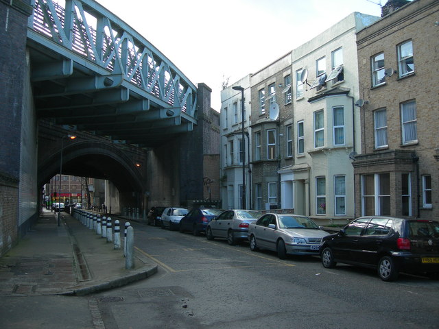
English: Loveridge Road, NW6 Looking towards Kilburn High Road. The houses nearest the railway bridge will be in almost permanent shade as it blocks out most of their sunlight. Also, it carries the busy Jubilee and Metropolitan Underground lines, plus the Chiltern Line from Marylebone uses the bridge immediately beyond it. They must be very gloomy, noisy places to live.
|
| ⧼wm-license-information-date⧽ | 2007 |
| ⧼wm-license-information-source⧽ | From geograph.org.uk |
| ⧼wm-license-information-author⧽ | Danny Robinson |
51°32′50″N 0°11′58″W / 51.54723°N 0.1995°W قالب:Object location
_heading:247)
ترخيص
تاريخ الملف
اضغط على زمن/تاريخ لرؤية الملف كما بدا في هذا الزمن.
| زمن/تاريخ | صورة مصغرة | الأبعاد | مستخدم | تعليق | |
|---|---|---|---|---|---|
| حالي | ★ مراجعة معتمدة 19:09، 30 نوفمبر 2023 | | 640 × 480 (114 كيلوبايت) | Pastakhov (نقاش | مساهمات) | Upload https://upload.wikimedia.org/wikipedia/commons/4/44/Loveridge_Road%2C_NW6_-_geograph.org.uk_-_372550.jpg |
لا يمكنك استبدال هذا الملف.
وصلات
لا يوجد صفحات تصل لهذه الصورة.