ملف:Long Lane - geograph.org.uk - 1652364.jpg
لا توجد دقة أعلى متوفرة.
Long_Lane_-_geograph.org.uk_-_1652364.jpg (640 × 427 بكسل حجم الملف: 178 كيلوبايت، نوع MIME: image/jpeg)
وصف قصير
| ⧼wm-license-information-description⧽ |
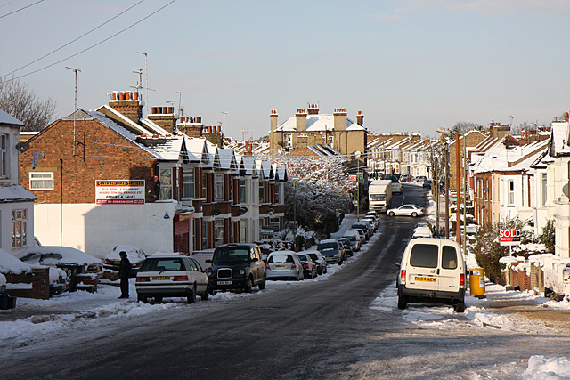
English: Long Lane Looking across the dip by Cromwell and Montpelier Road's from the junction with Abingdon Road. The dip forms the lowest point along the lane and is sometimes liable to flooding. Beyond the Lane climbs up to the junction with Squires Lane before a kink to the left and continuing its climb to Church End and Ballards Lane.
Not too sure what the driver of the Mercedes was doing but it doesn't seem to have involved hitting anything. Long Lane was gritted but the snow has stuck to the road regardless as the temperatures fell below Zero and stayed there.
|
| ⧼wm-license-information-date⧽ | 2010 |
| ⧼wm-license-information-source⧽ | From geograph.org.uk |
| ⧼wm-license-information-author⧽ | Martin Addison |
| ⧼wm-license-cc-attribution⧽ (قالب:I18n/Credit line) |
Martin Addison / Long Lane / |
51°35′56″N 0°10′47″W / 51.59882°N 0.1798°W قالب:Object location
_heading:315)
ترخيص
تاريخ الملف
اضغط على زمن/تاريخ لرؤية الملف كما بدا في هذا الزمن.
| زمن/تاريخ | صورة مصغرة | الأبعاد | مستخدم | تعليق | |
|---|---|---|---|---|---|
| حالي | ★ مراجعة معتمدة 05:34، 28 أكتوبر 2023 | | 640 × 427 (178 كيلوبايت) | Pastakhov (نقاش | مساهمات) | Upload https://upload.wikimedia.org/wikipedia/commons/7/74/Long_Lane_-_geograph.org.uk_-_1652364.jpg |
لا يمكنك استبدال هذا الملف.
وصلات
لا يوجد صفحات تصل لهذه الصورة.