ملف:Location of Makit within Xinjiang (China).png
حجم هذه المعاينة: 789 × 600 بكسل. البعد الآخر: 960 × 730 بكسل.
الملف الأصلي (960 × 730 بكسل حجم الملف: 164 كيلوبايت، نوع MIME: image/png)
| أجزاء من هذا ملف (أولئك المتعلقين بـ The China-Tajikistan border has been altered and Kunyu, Xinjiang has been created.) تحتاج أن تـُحدَّث. فضلاً، حدِّث هذا ملف ليعكس الأحداث الأخيرة أو المعطيات التي توفرت مؤخراً. (February 2020) |
وصف قصير
| ⧼wm-license-information-description⧽ |
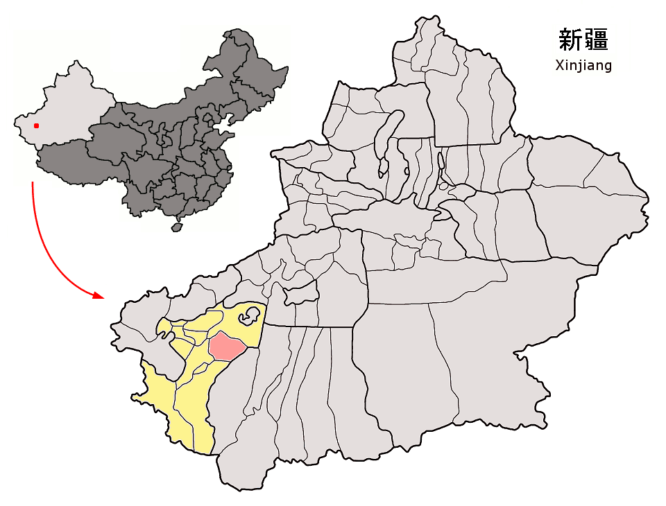
English: Location of Makit County (pink) and Kashgar Prefecture (yellow) within Xinjiang Uyghur Autonomous Region (light gray) of the People's Republic of China (dark gray)
Map drawn in september 2007 using various sources, mainly : |
| ⧼wm-license-information-date⧽ | 2007 |
| ⧼wm-license-information-source⧽ | ⧼Wm-license-own-work⧽ |
| ⧼wm-license-information-author⧽ | Croquant |
ترخيص
تاريخ الملف
اضغط على زمن/تاريخ لرؤية الملف كما بدا في هذا الزمن.
| زمن/تاريخ | صورة مصغرة | الأبعاد | مستخدم | تعليق | |
|---|---|---|---|---|---|
| حالي | ★ مراجعة معتمدة 10:04، 12 نوفمبر 2023 | | 960 × 730 (164 كيلوبايت) | Pastakhov (نقاش | مساهمات) | Upload https://upload.wikimedia.org/wikipedia/commons/d/db/Location_of_Makit_within_Xinjiang_%28China%29.png |
لا يمكنك استبدال هذا الملف.
وصلات
لا يوجد صفحات تصل لهذه الصورة.
.png&oldid=3485825)