ملف:Litchfield County Connecticut Incorporated and Unincorporated areas New Milford Highlighted 2010.svg

حجم معاينة PNG لذلك الملف ذي الامتداد SVG: 800 × 463 بكسل. البعد الآخر: 2٬560 × 1٬482 بكسل.
الملف الأصلي (ملف SVG، أبعاده 950 × 550 بكسل، حجم الملف: 82 كيلوبايت)
وصف قصير
| ⧼wm-license-information-description⧽ |
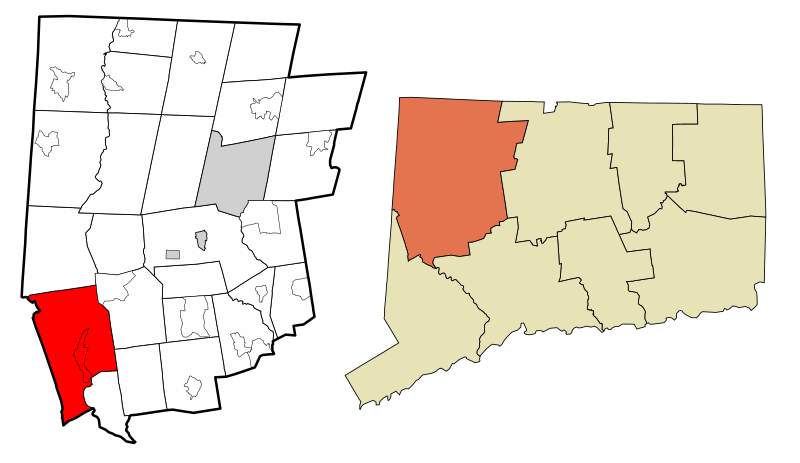
English: Map showing the location of this town within Litchfield County, Connecticut. Data source: 2010 U.S. census
|
| ⧼wm-license-information-date⧽ | 2020 |
| ⧼wm-license-information-source⧽ | ⧼Wm-license-own-work⧽ |
| ⧼wm-license-information-author⧽ | ECTran71, based on other works by DemocraticLuntz and Arkyan |
ترخيص
|
تاريخ الملف
اضغط على زمن/تاريخ لرؤية الملف كما بدا في هذا الزمن.
| زمن/تاريخ | صورة مصغرة | الأبعاد | مستخدم | تعليق | |
|---|---|---|---|---|---|
| حالي | ★ مراجعة معتمدة 21:31، 19 أكتوبر 2023 | | 950 × 550 (82 كيلوبايت) | Pastakhov (نقاش | مساهمات) | Upload https://upload.wikimedia.org/wikipedia/commons/f/fb/Litchfield_County_Connecticut_Incorporated_and_Unincorporated_areas_New_Milford_Highlighted_2010.svg |
لا يمكنك استبدال هذا الملف.
وصلات
لا يوجد صفحات تصل لهذه الصورة.