ملف:Liberty Battlefield Missouri.jpg
حجم هذه المعاينة: 463 × 599 بكسل. البعد الآخر: 850 × 1٬100 بكسل.
الملف الأصلي (850 × 1٬100 بكسل حجم الملف: 298 كيلوبايت، نوع MIME: image/jpeg)
وصف قصير
| ⧼wm-license-information-description⧽ |
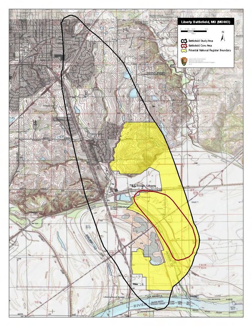
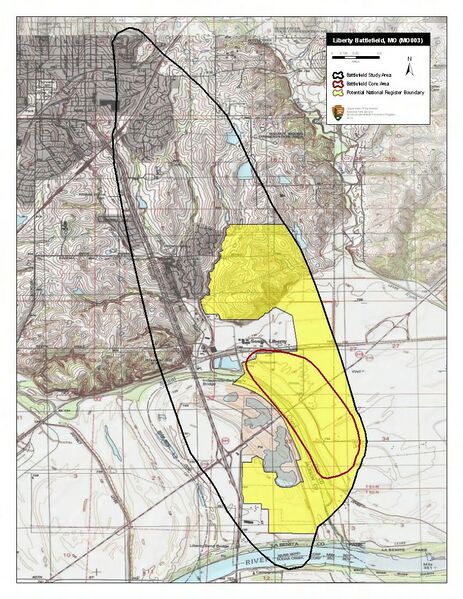
English: Map of battlefield core and study areas.
Little information is available about this battle. The ABPP was unable to verify the precise location of Blue Mills Landing, where the general engagement began. Historical sources do agree that Union forces retreated to Liberty and used the William Jewel College as a hospital for their wounded. The ABPP expanded the 1993 Study Area to include the college and narrowed the route of approach. The ABPP also narrowed the 1993 Core Area because it could find no evidence that Confederate units fired from across the river. |
| ⧼wm-license-information-date⧽ | 2011 |
| ⧼wm-license-information-source⧽ | National Park Service |
| ⧼wm-license-information-author⧽ | American Battlefield Protection Program |
ترخيص
تاريخ الملف
اضغط على زمن/تاريخ لرؤية الملف كما بدا في هذا الزمن.
| زمن/تاريخ | صورة مصغرة | الأبعاد | مستخدم | تعليق | |
|---|---|---|---|---|---|
| حالي | ★ مراجعة معتمدة 14:49، 9 نوفمبر 2023 | | 850 × 1٬100 (298 كيلوبايت) | Pastakhov (نقاش | مساهمات) | Upload https://upload.wikimedia.org/wikipedia/commons/b/b0/Liberty_Battlefield_Missouri.jpg |
لا يمكنك استبدال هذا الملف.
وصلات
لا يوجد صفحات تصل لهذه الصورة.