ملف:Larche.JPG
حجم هذه المعاينة: 800 × 533 بكسل. البعدان الآخران: 2٬560 × 1٬707 بكسل | 3٬456 × 2٬304 بكسل.
الملف الأصلي (3٬456 × 2٬304 بكسل حجم الملف: 5٫08 ميجابايت، نوع MIME: image/jpeg)
وصف قصير
| ⧼wm-license-information-description⧽ |
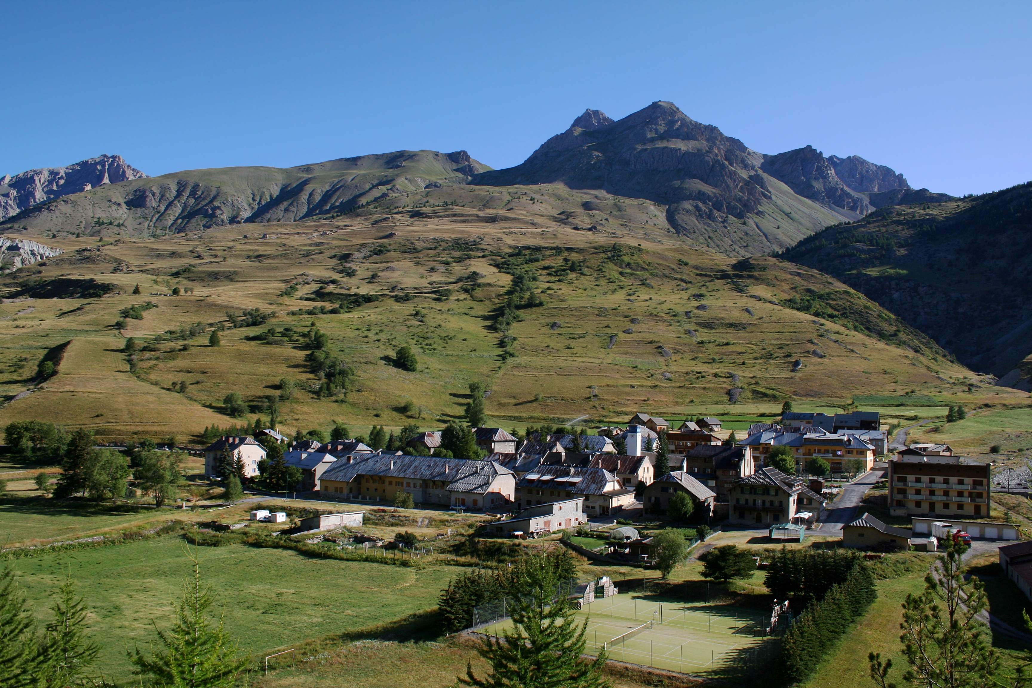
English: The village of Larche, in the Ubayette Valley. Alpes-de-Haute-Provence département, France. The following summits are visible behind the village, from the left to the right: The Tête des Bréquets (Litt.: Head of the Bréquets), the Côte des Chamois (Litt.: Slope of the Chamois), The Meyna, the Tête de la Virrayasse, and the Tête de Sautron.
Français : Le village de Larche, dans la Vallée de l'Ubayette. Alpes-de-Haute-Provence, France. Derrière le village on distingue, de gauche à droite, la Tête des Bréquets, la Côte des Chamois, la Meyna, la Tête de la Virrayasse, et la Tête de Sautron.
|
| ⧼wm-license-information-date⧽ | 2009 |
| ⧼wm-license-information-source⧽ | ⧼Wm-license-own-work⧽ |
| ⧼wm-license-information-author⧽ | Berrucomons |
44°26′55.99″N 6°50′41.8″E / 44.4488861°N 6.844944°E قالب:VI
ترخيص
|

تاريخ الملف
اضغط على زمن/تاريخ لرؤية الملف كما بدا في هذا الزمن.
| زمن/تاريخ | صورة مصغرة | الأبعاد | مستخدم | تعليق | |
|---|---|---|---|---|---|
| حالي | ★ مراجعة معتمدة 12:35، 14 أكتوبر 2023 | | 3٬456 × 2٬304 (5٫08 ميجابايت) | Pastakhov (نقاش | مساهمات) | Upload https://upload.wikimedia.org/wikipedia/commons/5/5d/Larche.JPG |
لا يمكنك استبدال هذا الملف.
وصلات
لا يوجد صفحات تصل لهذه الصورة.