ملف:Lantau island full.jpg
حجم هذه المعاينة: 800 × 600 بكسل. البعد الآخر: 2٬048 × 1٬536 بكسل.
الملف الأصلي (2٬048 × 1٬536 بكسل حجم الملف: 711 كيلوبايت، نوع MIME: image/jpeg)
وصف قصير
| ⧼wm-license-information-description⧽ |
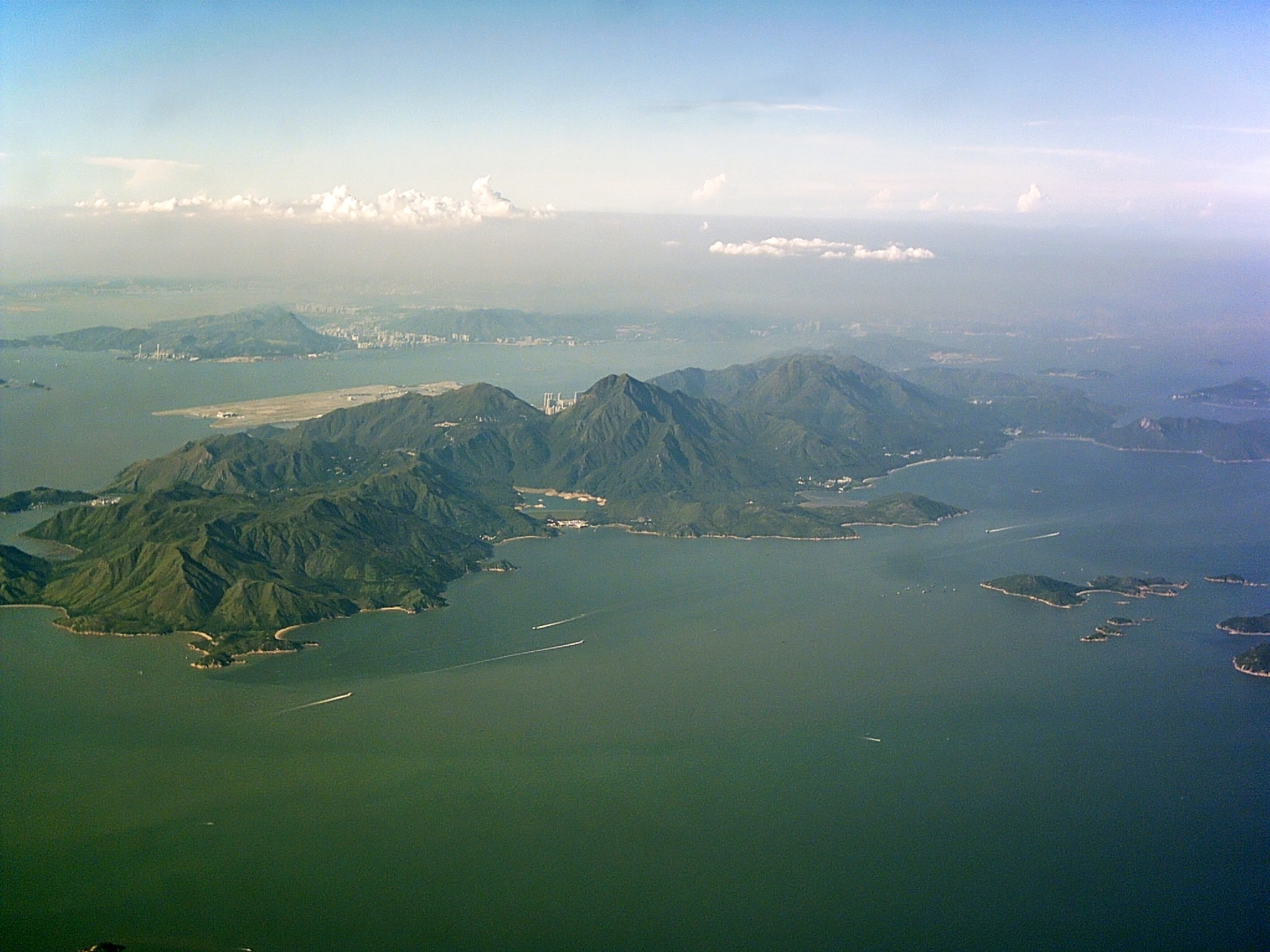
English: The mountainous Lantau Island, stretching from the centre left to up right, Soko Islands in the centre right, Hei Ling Chau directly above the Chi Ma Wan Peninsula, Peng Chau to its left. Chek Lap Kok Airport north of Lantau Island, Tuen Mun directly above. Shenzhen can be seen through the thick haze.
صينية: 圖片中間是大嶼山,見到石壁水塘、東涌和香港國際機場。中右方是索罟群島,而中上方就是屯門和踏石角。透过厚厚的煙霞可以看见深圳。 |
| ⧼wm-license-information-date⧽ | 2004 |
| ⧼wm-license-information-source⧽ | ⧼Wm-license-own-work⧽ |
| ⧼wm-license-information-author⧽ | Typhoonchaser |
ترخيص
|

تاريخ الملف
اضغط على زمن/تاريخ لرؤية الملف كما بدا في هذا الزمن.
| زمن/تاريخ | صورة مصغرة | الأبعاد | مستخدم | تعليق | |
|---|---|---|---|---|---|
| حالي | ★ مراجعة معتمدة 06:08، 7 نوفمبر 2023 | | 2٬048 × 1٬536 (711 كيلوبايت) | Pastakhov (نقاش | مساهمات) | Upload https://upload.wikimedia.org/wikipedia/commons/d/d5/Lantau_island_full.jpg |
لا يمكنك استبدال هذا الملف.
وصلات
لا يوجد صفحات تصل لهذه الصورة.