ملف:Lancashire and Yorkshire Railway Map at Manchester Victoria.jpg

حجم هذه المعاينة: 800 × 533 بكسل. البعدان الآخران: 2٬560 × 1٬707 بكسل | 4٬272 × 2٬848 بكسل.
الملف الأصلي (4٬272 × 2٬848 بكسل حجم الملف: 4 ميجابايت، نوع MIME: image/jpeg)
وصف قصير
| ⧼wm-license-information-description⧽ |
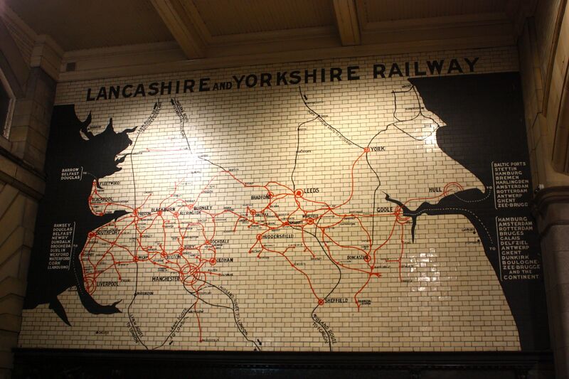
A map showing the routes operated by the Lancashire and Yorkshire Railway, who built Manchester Victoria station where this is located. One of the larger railway companies of the 19th century, controlling track across the north of England. |
| ⧼wm-license-information-date⧽ | 2013, {{time}} – invalid date format 54 (help) |
| ⧼wm-license-information-source⧽ | Lancashire and Yorkshire Railway Map |
| ⧼wm-license-information-author⧽ | Neil Turner from Sowerby Bridge, United Kingdom |
ترخيص
تاريخ الملف
اضغط على زمن/تاريخ لرؤية الملف كما بدا في هذا الزمن.
| زمن/تاريخ | صورة مصغرة | الأبعاد | مستخدم | تعليق | |
|---|---|---|---|---|---|
| حالي | ★ مراجعة معتمدة 15:52، 12 يناير 2024 | | 4٬272 × 2٬848 (4 ميجابايت) | Pastakhov (نقاش | مساهمات) | Upload https://upload.wikimedia.org/wikipedia/commons/3/37/Lancashire_and_Yorkshire_Railway_Map_at_Manchester_Victoria.jpg |
لا يمكنك استبدال هذا الملف.
وصلات
لا يوجد صفحات تصل لهذه الصورة.