ملف:LakeCrescentContour.png
حجم هذه المعاينة: 800 × 400 بكسل. البعدان الآخران: 2٬560 × 1٬280 بكسل | 7٬200 × 3٬600 بكسل.
الملف الأصلي (7٬200 × 3٬600 بكسل حجم الملف: 1٫65 ميجابايت، نوع MIME: image/png)
وصف قصير
| ⧼wm-license-information-description⧽ |
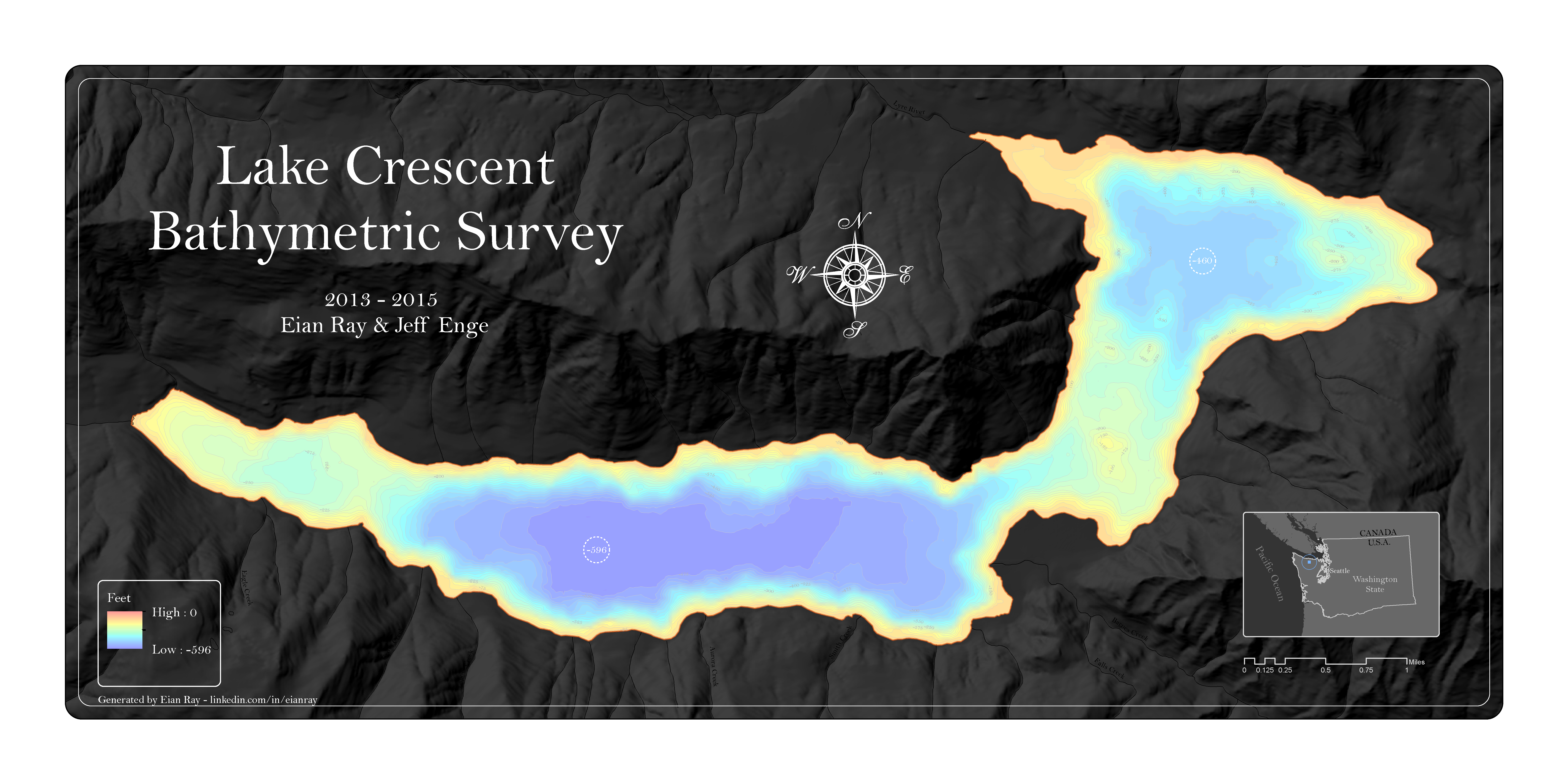
English: Map of Lake Crescent showing bathymetric lines at 25 foot intervals. Bathymetric contours were generated through an interpolation process of over 5,000 soundings.
|
| ⧼wm-license-information-date⧽ | 2016 |
| ⧼wm-license-information-source⧽ | ⧼Wm-license-own-work⧽ |
| ⧼wm-license-information-author⧽ | Eian Ray |
48°03′39″N 123°49′26″W / 48.060939°N 123.823878°W
ترخيص
|
تاريخ الملف
اضغط على زمن/تاريخ لرؤية الملف كما بدا في هذا الزمن.
| زمن/تاريخ | صورة مصغرة | الأبعاد | مستخدم | تعليق | |
|---|---|---|---|---|---|
| حالي | ★ مراجعة معتمدة 10:43، 12 يناير 2024 | | 7٬200 × 3٬600 (1٫65 ميجابايت) | Pastakhov (نقاش | مساهمات) | Upload https://upload.wikimedia.org/wikipedia/commons/8/88/LakeCrescentContour.png |
لا يمكنك استبدال هذا الملف.
وصلات
لا يوجد صفحات تصل لهذه الصورة.