ملف:Lageplan KZ Salzgitter-Watenstedt.jpg
حجم هذه المعاينة: 800 × 600 بكسل. البعدان الآخران: 2٬560 × 1٬919 بكسل | 3٬023 × 2٬266 بكسل.
الملف الأصلي (3٬023 × 2٬266 بكسل حجم الملف: 482 كيلوبايت، نوع MIME: image/jpeg)
وصف قصير
| ⧼wm-license-information-description⧽ |
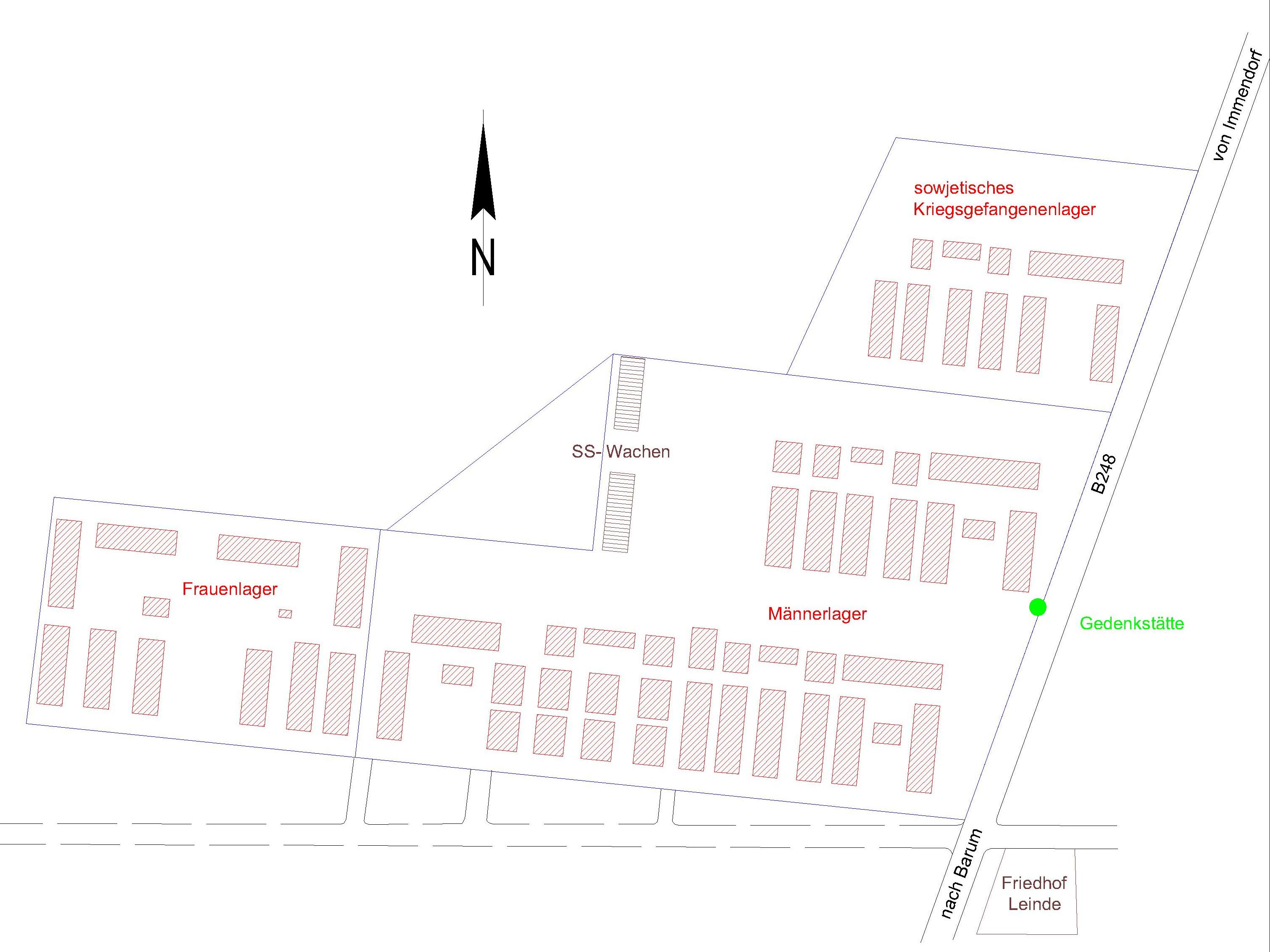
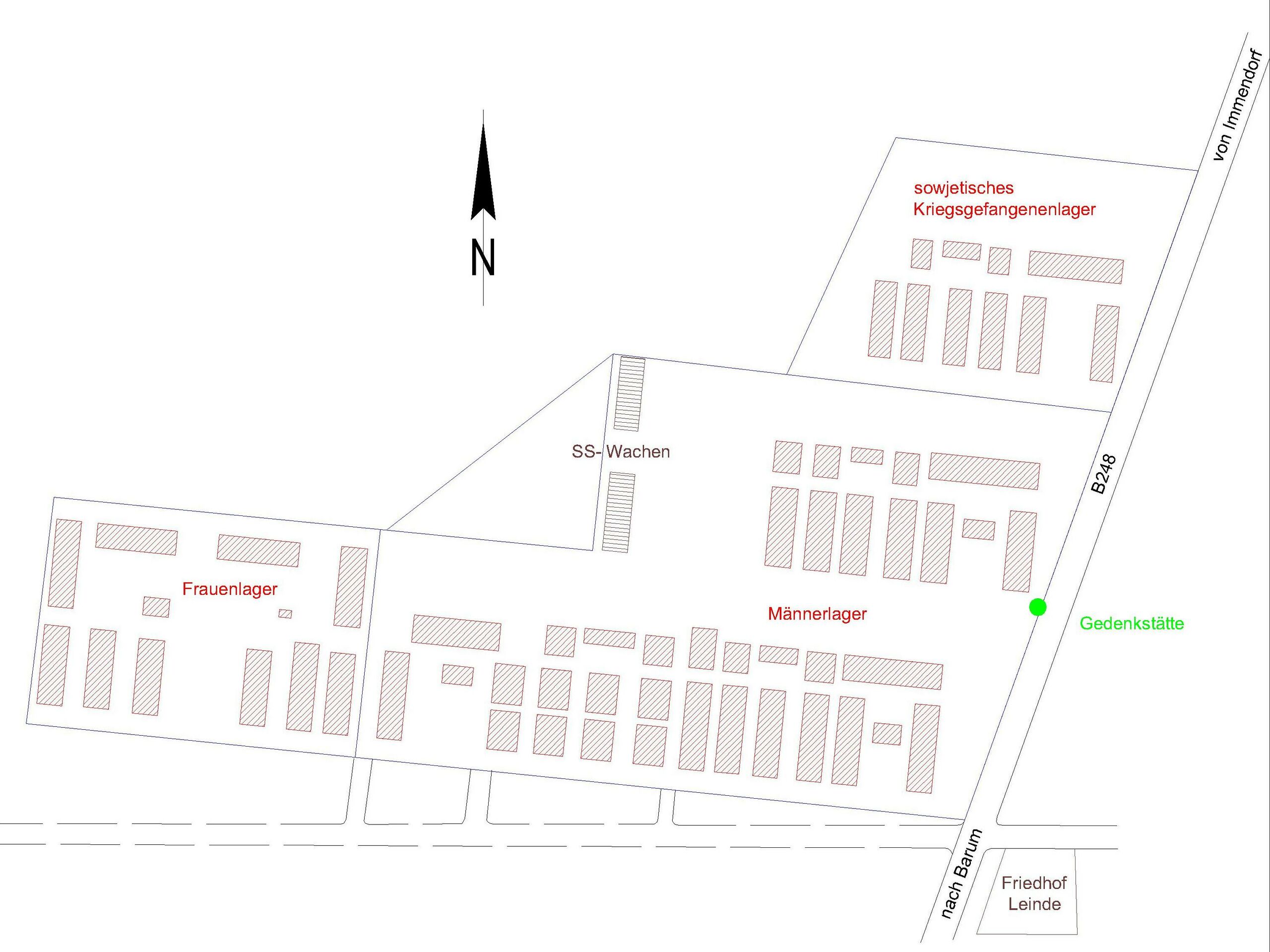
English: Nazi concentration camp Salzgitter-Watenstedt, situation plan. Bundesstrasse B248 near Salzgitter-Leinde, Salzgitter, Lower Saxony, Germany.
Deutsch: Schematischer Lageplan KZ Salzgitter-Watenstedt. B248 Höhe SZ-Leinde, Salzgitter, Niedersachsen, Deutschland.
|
| ⧼wm-license-information-date⧽ | 2016 |
| ⧼wm-license-information-source⧽ | ⧼Wm-license-own-work⧽ |
| ⧼wm-license-information-author⧽ | Markscheider |
ترخيص
|
تاريخ الملف
اضغط على زمن/تاريخ لرؤية الملف كما بدا في هذا الزمن.
| زمن/تاريخ | صورة مصغرة | الأبعاد | مستخدم | تعليق | |
|---|---|---|---|---|---|
| حالي | ★ مراجعة معتمدة 10:44، 12 نوفمبر 2023 | | 3٬023 × 2٬266 (482 كيلوبايت) | Pastakhov (نقاش | مساهمات) | Upload https://upload.wikimedia.org/wikipedia/commons/b/bf/Lageplan_KZ_Salzgitter-Watenstedt.jpg |
لا يمكنك استبدال هذا الملف.
وصلات
لا يوجد صفحات تصل لهذه الصورة.