ملف:Léman Bathymétrie.png

حجم هذه المعاينة: 800 × 510 بكسل. البعدان الآخران: 2٬560 × 1٬633 بكسل | 3٬511 × 2٬239 بكسل.
الملف الأصلي (3٬511 × 2٬239 بكسل حجم الملف: 4٫61 ميجابايت، نوع MIME: image/png)
وصف قصير
| ⧼wm-license-information-description⧽ |
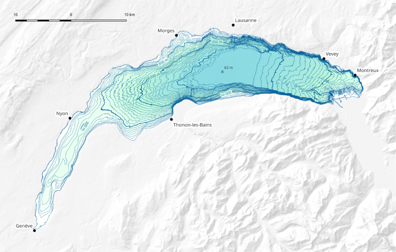
Français : Carte bathymétrique du Léman
|
| ⧼wm-license-information-date⧽ | 2022 |
| ⧼wm-license-information-source⧽ | ⧼Wm-license-own-work⧽ |
| ⧼wm-license-information-author⧽ | JRagusa Sources des données :
|
ترخيص
|
تاريخ الملف
اضغط على زمن/تاريخ لرؤية الملف كما بدا في هذا الزمن.
| زمن/تاريخ | صورة مصغرة | الأبعاد | مستخدم | تعليق | |
|---|---|---|---|---|---|
| حالي | ★ مراجعة معتمدة 15:25، 10 أكتوبر 2023 | | 3٬511 × 2٬239 (4٫61 ميجابايت) | Pastakhov (نقاش | مساهمات) | Upload https://upload.wikimedia.org/wikipedia/commons/5/5c/L%C3%A9man_Bathym%C3%A9trie.png |
لا يمكنك استبدال هذا الملف.
وصلات
لا يوجد صفحات تصل لهذه الصورة.