ملف:Knights Ferry covered bridge Stanislaus River.jpg
حجم هذه المعاينة: 800 × 562 بكسل. البعد الآخر: 1٬500 × 1٬053 بكسل.
الملف الأصلي (1٬500 × 1٬053 بكسل حجم الملف: 772 كيلوبايت، نوع MIME: image/jpeg)
| ⧼wm-license-information-description⧽ |
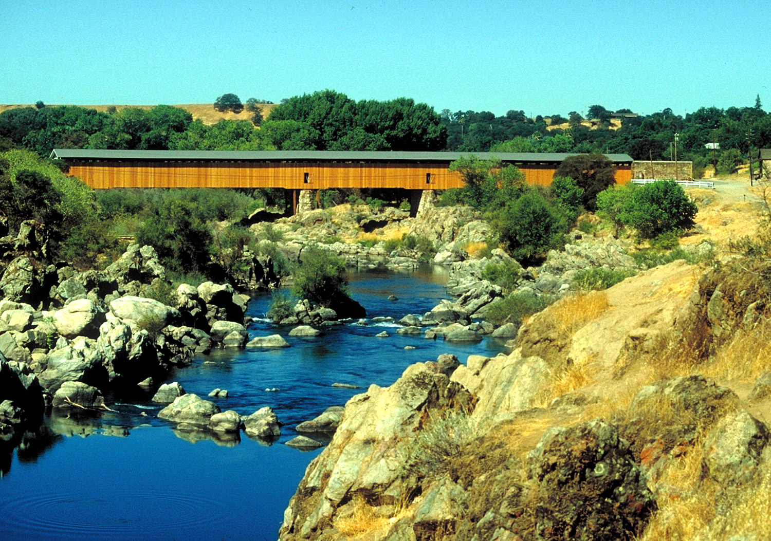
English: The Knights Ferry covered bridge on the Stanislaus River in Stanislaus County, California, USA. The bridge is located in the Knights Ferry Recreation Area, approximately 11 miles (18 km) east-northeast of Oakdale, California. The bridge was constructed in 1864 to replace a ferry established in 1848 by Dr. William Knight. The bridge was weakened by an overweight truck and closed to vehicular traffic in 1981. Restored by the U.S. Army Corps of Engineers, it was incorporated into the recreation area. The bridge is 330 feet (100 m) long and is the longest covered bridge west of the Mississippi River. The bridge is a National Historic Landmark on the National Register of Historic Places.
|
| ⧼wm-license-information-date⧽ | 1995-07-01 (Caveat: Dates provided by U.S. Army Corps of Engineers Digital Visual Library are not reliable and may be wrong.) |
| ⧼wm-license-information-source⧽ | U.S. Army Corps of Engineers Digital Visual Library Image page Image description page Digital Visual Library home page |
| ⧼wm-license-information-author⧽ | Michael Nevins, U.S. Army Corps of Engineers |
| ⧼wm-license-information-permission⧽ (⧼wm-license-information-permission-reusing-text⧽) |
|
| قالب:Location/i18n | Stanislaus County, California, USA |
تاريخ الملف
اضغط على زمن/تاريخ لرؤية الملف كما بدا في هذا الزمن.
| زمن/تاريخ | صورة مصغرة | الأبعاد | مستخدم | تعليق | |
|---|---|---|---|---|---|
| حالي | ★ مراجعة معتمدة 07:43، 2 ديسمبر 2023 | | 1٬500 × 1٬053 (772 كيلوبايت) | Pastakhov (نقاش | مساهمات) | Upload https://upload.wikimedia.org/wikipedia/commons/a/a6/Knights_Ferry_covered_bridge_Stanislaus_River.jpg |
لا يمكنك استبدال هذا الملف.
وصلات
لا يوجد صفحات تصل لهذه الصورة.