ملف:Kirkby Town Centre - geograph.org.uk - 122465.jpg
لا توجد دقة أعلى متوفرة.
Kirkby_Town_Centre_-_geograph.org.uk_-_122465.jpg (640 × 480 بكسل حجم الملف: 60 كيلوبايت، نوع MIME: image/jpeg)
وصف قصير
| ⧼wm-license-information-description⧽ |
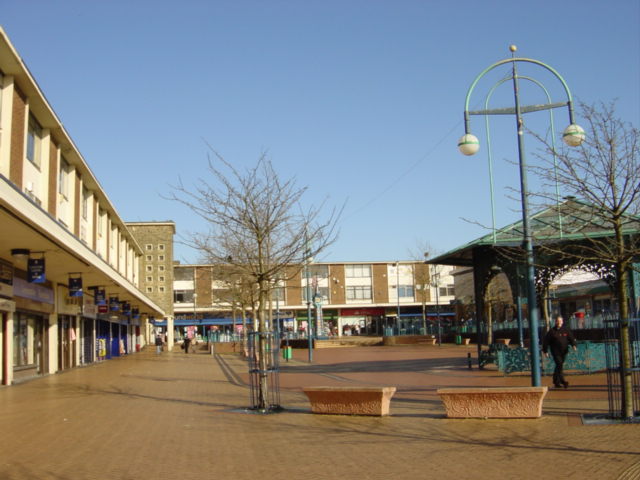
English: Kirkby centre. Looking north from Newtown Gardens.
The "Newtown" (remember Z cars?) of Kirkby owes its being to the closure of the Royal Ordnance Factory in 1946 when the Government suggested to Liverpool City Council that making use of some of the thousand buildings and creating a large trading/industrial estate would provide jobs for redundant workers and the demobbed. The trading estate steadily expanded through the 1950s and 1960s to become one of the largest in the country, at its peak in 1971, the estate employed over 26,000 people. A model town of 10,000 houses was constructed, mainly as an overspill for Liverpool, on what was once agricultural land and the modest population of 3,000 expanded to 50,000 by 1961. New facilities to cater for the growing population included a variety of shops, banks and business premises, a library and a market, probably the only surviving outdoor market on Merseyside.
|
| ⧼wm-license-information-date⧽ | 2006 |
| ⧼wm-license-information-source⧽ | From geograph.org.uk |
| ⧼wm-license-information-author⧽ | Sue Adair |
| ⧼wm-license-cc-attribution⧽ (قالب:I18n/Credit line) |
Sue Adair / Kirkby Town Centre / |
ترخيص
تاريخ الملف
اضغط على زمن/تاريخ لرؤية الملف كما بدا في هذا الزمن.
| زمن/تاريخ | صورة مصغرة | الأبعاد | مستخدم | تعليق | |
|---|---|---|---|---|---|
| حالي | ★ مراجعة معتمدة 02:59، 27 نوفمبر 2023 | | 640 × 480 (60 كيلوبايت) | Pastakhov (نقاش | مساهمات) | Upload https://upload.wikimedia.org/wikipedia/commons/1/18/Kirkby_Town_Centre_-_geograph.org.uk_-_122465.jpg |
لا يمكنك استبدال هذا الملف.
وصلات
لا يوجد صفحات تصل لهذه الصورة.