ملف:Kingdom of Numidia-02.png
حجم هذه المعاينة: 800 × 346 بكسل. البعد الآخر: 2٬246 × 971 بكسل.
الملف الأصلي (2٬246 × 971 بكسل حجم الملف: 495 كيلوبايت، نوع MIME: image/png)
وصف قصير
| ⧼wm-license-information-description⧽ |
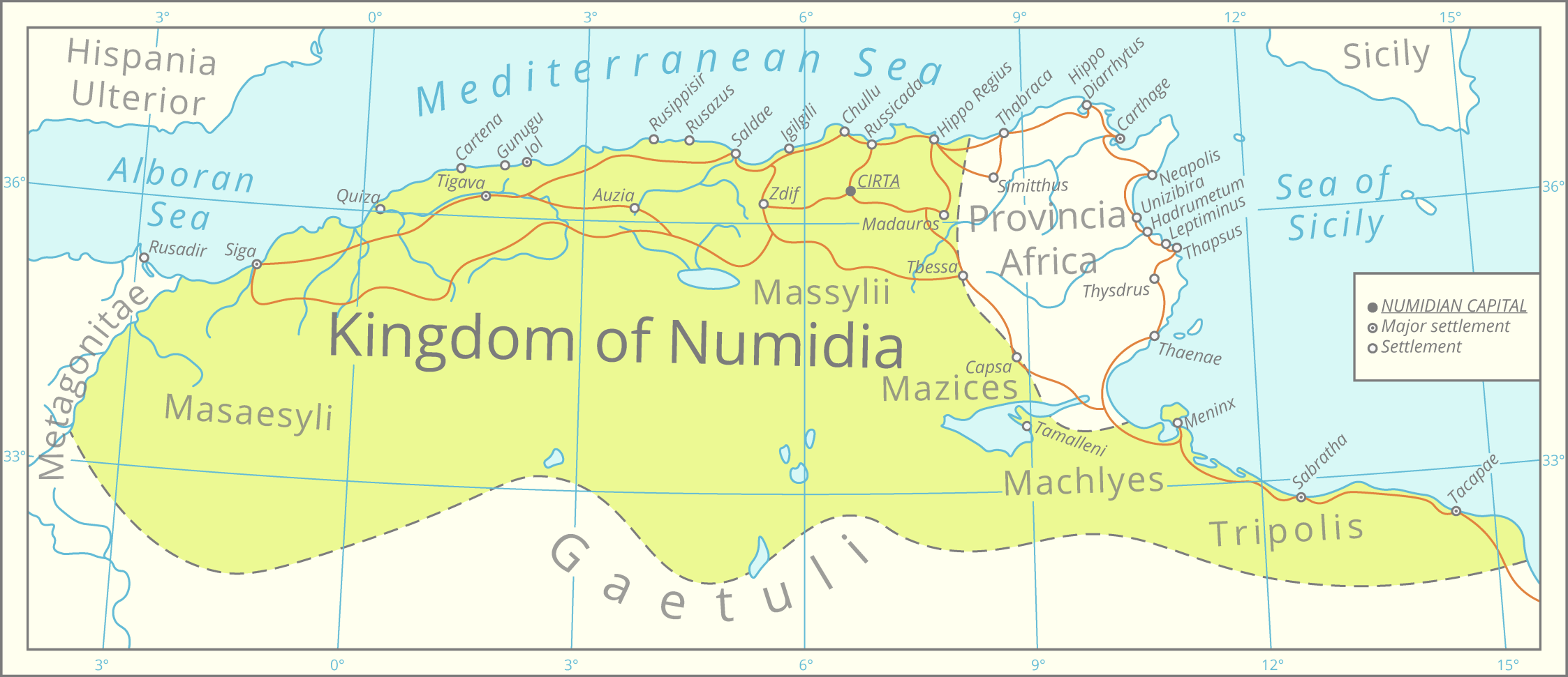
English: This map was assembled using the boundaries of this map, Roman road data from this [1] dataset, river and lake data from the Pergamon Atlas as well as settlement significance from the Barrington Atlas.
The graphics were assembled in QGIS and processed in Adobe Illustrator. All data is projected in the Lambert azimuthal equal-area projection.
|
| ⧼wm-license-information-date⧽ | 2021 |
| ⧼wm-license-information-source⧽ | ⧼Wm-license-own-work⧽ |
| ⧼wm-license-information-author⧽ | Cattette |
ترخيص
تاريخ الملف
اضغط على زمن/تاريخ لرؤية الملف كما بدا في هذا الزمن.
| زمن/تاريخ | صورة مصغرة | الأبعاد | مستخدم | تعليق | |
|---|---|---|---|---|---|
| حالي | ★ مراجعة معتمدة 11:30، 26 ديسمبر 2023 | | 2٬246 × 971 (495 كيلوبايت) | Pastakhov (نقاش | مساهمات) | Upload https://upload.wikimedia.org/wikipedia/commons/f/fe/Kingdom_of_Numidia-02.png |
لا يمكنك استبدال هذا الملف.
وصلات
لا يوجد صفحات تصل لهذه الصورة.