ملف:Karte mit alter weisseritz.JPG
حجم هذه المعاينة: 439 × 599 بكسل. البعد الآخر: 1٬633 × 2٬230 بكسل.
الملف الأصلي (1٬633 × 2٬230 بكسل حجم الملف: 818 كيلوبايت، نوع MIME: image/jpeg)
| ⧼wm-license-information-description⧽ |
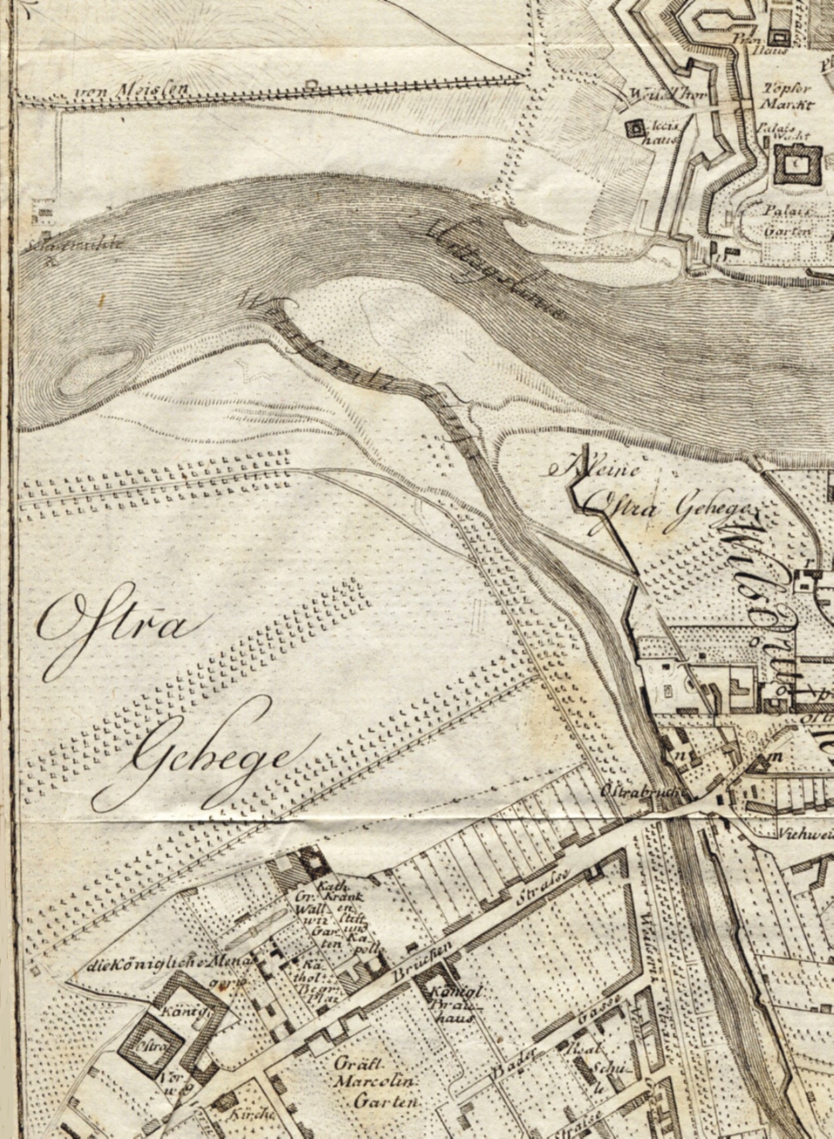
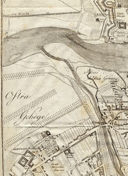
English: city map of Dresden (part of plan with Ostragehege), J. Georg Lehmann, delineated 1801, improved 1804, printed 1809
Deutsch: Stadtplan von Dresden (Ausschnitt mit Ostragehege) von J. Georg Lehmann, gezeichnet 1801, verbessert 1804, gedruckt 1809
|
| ⧼wm-license-information-date⧽ | 1809 |
| ⧼wm-license-information-source⧽ | Eigenes Scan (own scan) |
| ⧼wm-license-information-author⧽ | Lysippos |
|
|
This file is in the ملكية عامة because its copyright has expired in the United States and those countries with a copyright term of no more than the life of the author plus 100 years.
|
source: [Friedrich Christian August Hasse]: Dresden und die umliegende Gegend bis Elsterwerda, Bautzen, Herrnhut, Rumburg, Aussig, Töplitz, Freyberg und Hubertusburg. Eine Darstellung für Natur- und Kunstfreunde. Erster Theil. 2. vermehrte Auflage, Dresden (Arnoldsche Buch- und Kunsthandlung) 1804
تاريخ الملف
اضغط على زمن/تاريخ لرؤية الملف كما بدا في هذا الزمن.
| زمن/تاريخ | صورة مصغرة | الأبعاد | مستخدم | تعليق | |
|---|---|---|---|---|---|
| حالي | ★ مراجعة معتمدة 01:39، 3 نوفمبر 2023 | | 1٬633 × 2٬230 (818 كيلوبايت) | Pastakhov (نقاش | مساهمات) | Upload https://upload.wikimedia.org/wikipedia/commons/6/6e/Karte_mit_alter_weisseritz.JPG |
لا يمكنك استبدال هذا الملف.
وصلات
لا يوجد صفحات تصل لهذه الصورة.