ملف:Karte Münchner Stadtbäche links der Isar.png
حجم هذه المعاينة: 439 × 600 بكسل. البعد الآخر: 1٬240 × 1٬694 بكسل.
الملف الأصلي (1٬240 × 1٬694 بكسل حجم الملف: 1٫67 ميجابايت، نوع MIME: image/png)
| ⧼wm-license-information-description⧽ |
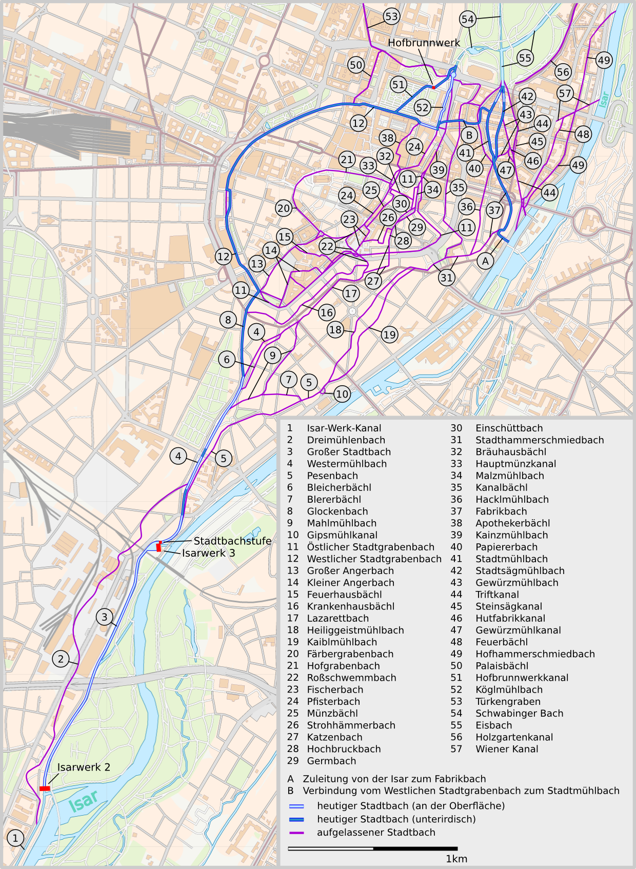
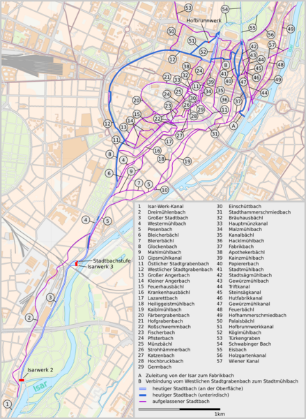
English: Map of existing and former town streams in Munich on the left side of river Isar
Deutsch: Karte der aufgelassenen und noch bestehenden Münchner Stadtbäche links der Isar
|
||
| ⧼wm-license-information-date⧽ | 2010 | ||
| ⧼wm-license-information-source⧽ |
|
||
| ⧼wm-license-information-author⧽ |
|
||
| ⧼wm-license-information-permission⧽ (⧼wm-license-information-permission-reusing-text⧽) |
|
تاريخ الملف
اضغط على زمن/تاريخ لرؤية الملف كما بدا في هذا الزمن.
| زمن/تاريخ | صورة مصغرة | الأبعاد | مستخدم | تعليق | |
|---|---|---|---|---|---|
| حالي | ★ مراجعة معتمدة 08:58، 2 ديسمبر 2023 | | 1٬240 × 1٬694 (1٫67 ميجابايت) | Pastakhov (نقاش | مساهمات) | Upload https://upload.wikimedia.org/wikipedia/commons/f/f3/Karte_M%C3%BCnchner_Stadtb%C3%A4che_links_der_Isar.png |
لا يمكنك استبدال هذا الملف.
وصلات
لا يوجد صفحات تصل لهذه الصورة.