ملف:Karte Innsbruck - Katastralgemeinden und Statistische Stadtteile.png
حجم هذه المعاينة: 435 × 599 بكسل. البعد الآخر: 1٬188 × 1٬635 بكسل.
الملف الأصلي (1٬188 × 1٬635 بكسل حجم الملف: 435 كيلوبايت، نوع MIME: image/png)
وصف قصير
| ⧼wm-license-information-description⧽ |
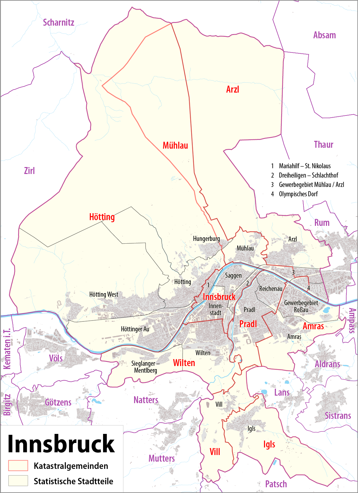
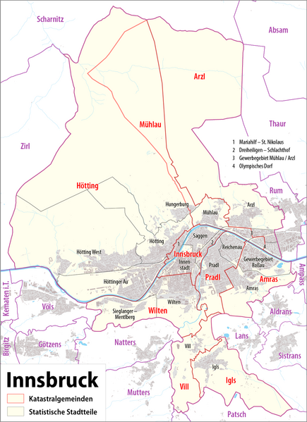
Deutsch: Karte von Innsbruck: Katastralgemeinden und statistische Stadtteile
English: Map of Innsbruck: cadastral communities and statistical districts
|
||
| ⧼wm-license-information-date⧽ | see file history | ||
| ⧼wm-license-information-source⧽ | ⧼Wm-license-own-work⧽, using
|
||
| ⧼wm-license-information-author⧽ | Maximilian Dörrbecker (Chumwa) | ||
| ⧼wm-license-information-permission⧽ (⧼wm-license-information-permission-reusing-text⧽) |
قالب:ODbL OpenStreetMap Sie dürfen das Bild zu den folgenden Bedingungen nutzen:
|
||
| ⧼wm-license-information-other-versions⧽ |
Statistical districs of Innsbruck
Cadastral communities of Innsbruck
|
تاريخ الملف
اضغط على زمن/تاريخ لرؤية الملف كما بدا في هذا الزمن.
| زمن/تاريخ | صورة مصغرة | الأبعاد | مستخدم | تعليق | |
|---|---|---|---|---|---|
| حالي | ★ مراجعة معتمدة 15:49، 22 نوفمبر 2023 | | 1٬188 × 1٬635 (435 كيلوبايت) | Pastakhov (نقاش | مساهمات) | Upload https://upload.wikimedia.org/wikipedia/commons/8/83/Karte_Innsbruck_-_Katastralgemeinden_und_Statistische_Stadtteile.png |
لا يمكنك استبدال هذا الملف.
وصلات
لا يوجد صفحات تصل لهذه الصورة.