ملف:Karte Flughafen Berlin Brandenburg.png
حجم هذه المعاينة: 784 × 600 بكسل. البعدان الآخران: 2٬560 × 1٬958 بكسل | 3٬500 × 2٬677 بكسل.
الملف الأصلي (3٬500 × 2٬677 بكسل حجم الملف: 2٫66 ميجابايت، نوع MIME: image/png)
وصف قصير
قالب:Image generation
| ⧼wm-license-information-description⧽ |
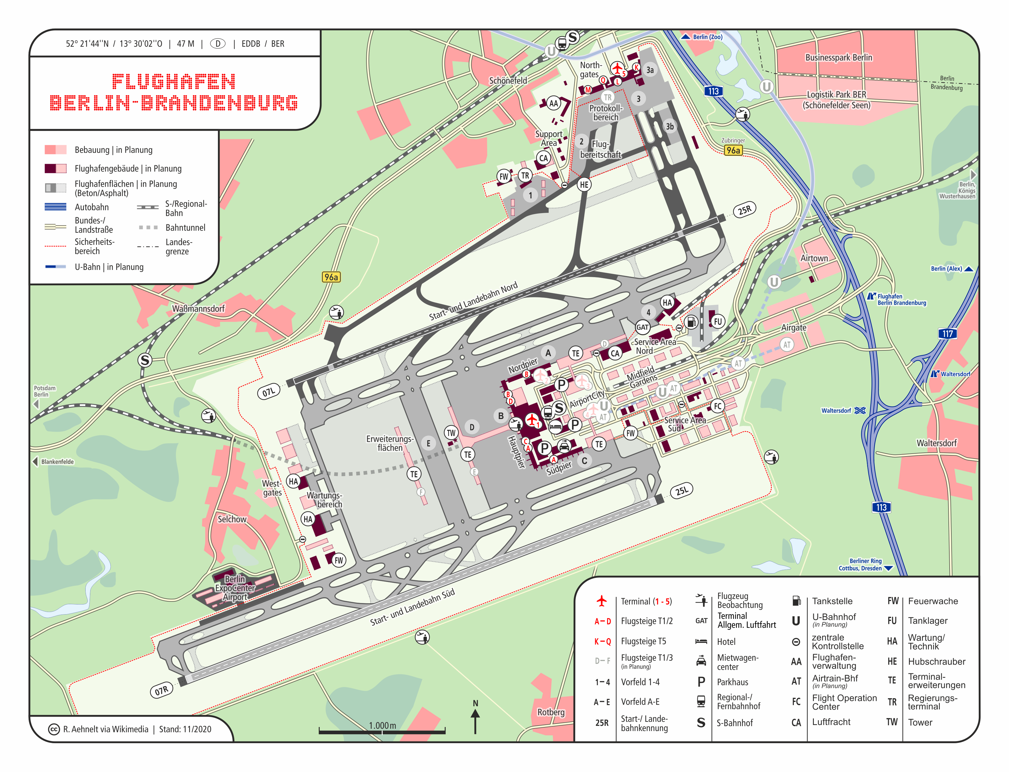
Deutsch: Karte & Lage-/ Übersichtsplan - Flughafen Berlin Brandenburg
(IATA: BER / ICAO: EDDB) |
|
| ⧼wm-license-information-date⧽ | 2011 | |
| ⧼wm-license-information-source⧽ | ⧼Wm-license-own-work⧽ / ملف:Bundesautobahn 113 number.svg / Datengrundlage: berlin-airport.de[dead link] |
|
| ⧼wm-license-information-author⧽ | CellarDoor85 (Robert Aehnelt) | |
| ⧼wm-license-information-permission⧽ (⧼wm-license-information-permission-reusing-text⧽) |
|
|
| ⧼wm-license-information-other-versions⧽ |
EN: ملف:Map Berlin Brandenburg Airport.png alt: ملف:Karte- Flughafen Berlin-Schönefeld SXF.png Twy: |

تاريخ الملف
اضغط على زمن/تاريخ لرؤية الملف كما بدا في هذا الزمن.
| زمن/تاريخ | صورة مصغرة | الأبعاد | مستخدم | تعليق | |
|---|---|---|---|---|---|
| حالي | ★ مراجعة معتمدة 11:53، 11 أكتوبر 2023 | | 3٬500 × 2٬677 (2٫66 ميجابايت) | Pastakhov (نقاش | مساهمات) | Upload https://upload.wikimedia.org/wikipedia/commons/6/62/Karte_Flughafen_Berlin_Brandenburg.png |
لا يمكنك استبدال هذا الملف.
وصلات
لا يوجد صفحات تصل لهذه الصورة.